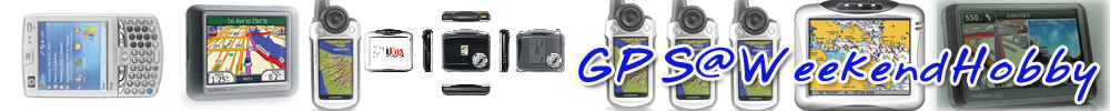
Λ”ΒΆΚΖ’η 2
GAMIN INTERNATIONAL THAILAND ύΛΟΉηΆß GPS Fishfinder 250 * . Garmin Mobile 10 - Super
®―¥ ηßΖ―η«ΜΟ–ύΖ» Ιψ®βΖΟΒ‘¥ΒηΆ ΆΚΕ“Νδ¥ι ΓΟΊ≥“ΚΆΓΟΊηΙψΥιΟ–ύΆ’¬¥ψΙΓ“Ο ―ηßΪΉιΆύΨΉηΆΦ≈ΜΟ–β¬ΣΙλΔΆßΖη“ΙψΙÓϮ―¥ ηß
=======Forerunner 305 */.
Forerunner 305 Ο«ΝύΆ“®Ί¥ύ¥ηΙΔΆß Forerunner ΖΊΓΟΊηΙΝ“ΦΙ«ΓΟ«ΝΓ―ΚύΛΟΉηΆß«―¥Ά―ΒϓÓΟύΒιΙΔΆßΥ―«ψ® Ζ”ψΥι 305 ύΜγΙ Ί¥¬Ά¥ΔΆßύΖΟΙύΙΆΟλ η«ΙΒ―«ΚΙΔιΆΝΉΆΔΆßΛΊ≥ Ζ’η®–«―¥Ά―ΒϓÓΟύΒιΙΔΆßΥ―«ψ® Ά―ΒϓÓΟύΦ“Φ≈“≠Ψ≈―ßß“Ι Φη“ΙΒ―««―¥Υ―«ψ®αΚΚδΟι “¬ ANT Ζ’ηΝ’Λ«“ΝαΝηΙ¬”α≈–ΖΙΖ“Ι
Forerunner 305 Ν’ΟΌΜ≈―Γ…≥λΖ’η «¬ß“ΝύΥΝΉΆΙΙ“Χ‘Γ“ΔιΆΝΉΆαΚΚ ΜΆΟλΒ δΝηύΨ’¬ßαΒη®–Ν’Λ«“Ν «¬ß“ΝύΖη“Ι―ιΙ 305 ¬―ßύΒγΝδ̥髬˫“Ν “Ν“ΟΕ ψΙΓ“ΟύΜγΙ personal trainer η«ΙΒ―«ΚΙΔιΆΝΉΆΔΆßΛΊ≥ α≈–ύΜγΙ GPS Ζ’η “Ν“ΟΕΚΆΓΛ«“ΝύΟγ« Ο–¬–Ζ“ß α≈–Ά―ΒϓÓϫ‘ηß (pace) ΔΆßΛΊ≥δ¥ιΆ¬η“ßαΝηΙ¬”⥬Ά“»―¬¥“«ύΖ’¬Ν Ϊ÷ηß®–ψΥιÓϢΆΓΓ”≈―ßΥΟΉΆΓ“ΟΩ‘ΒΪιΆΝύΜγΙδΜΆ¬η“ßΝ’ΜΟ– ‘ΖΗ‘ά“Ψ Όß Ί¥
Forerunner 305 ψΣιΣ‘Μ GPS ΟΊηΙ≈η“ Ί¥Ζ’ηΝ’Λ«“Νδ« Όß Ο―Κ ―≠≠“≥δ¥ιΖ―ιßψΙΚΟ‘ύ«≥Ζ’ηΝ’ΒιΙδΝιΥΙ“Ζ÷ΚΥΟΉΆψΙΜη“ΛΆΙΓΟ’Β Ά’ΓΖ―ιß͒ÓϢΆΓαΚΚύ “Ά“Γ“»Ϋ―ßΆ¬ΌηψΙ “¬Ι“Χ‘Γ“Ζ”ψΥιΟ―Κ ―≠≠“≥δ¥ιΆ¬η“߬Ά¥ύ¬’η¬Ν 305 ύΥΝΉΆΙΓ―Κ Forerunner ΟΊηΙΆΉηΙφ Ζ’ηΖ”ψΥιÓϫ‘ηßΔΆßΛΊ≥ß瓬Δ÷ιΙ β¥¬ΛΊ≥δΝηΒιΆß®¥ΔιΆΝΌ≈Óϫ‘ηßψΙαΒη≈–«―ΙΥΟΉΆ«‘ηßψΙύ ιΙΖ“ßΖ’η®”ύ®Ά’ΓΒηΆδΜ δΝη«η“ΛΊ≥ύΜγΙΙ―Γ«‘ηßύΨΉηΆαΔηßΔ―ΙΥΟΉΆύΨΉηΆ ΊΔά“Ψ Forerunner ύΥΝ“– ”ΥΟ―ΚΛΊ≥⥬ Forerunner ψΣιύΖΛβΙβ≈¬’≈η“ Ί¥ΔΆß GPS ύΨΉηΆΚΆΓΟ–¬–Ζ“ß Λ«“ΝύΟγ« α≈–ύ ιΙΖ“ßΓ≈―ΚΚι“ΙΔΆßΛΊ≥
Forerunner 305 ψΣιß“Ιß瓬α≈–Σ竬˺≥ύΓγΚ – ΝΔιΆΝΌ≈ΟΆΚÓϫ‘ηßΔΆßΛΊ≥ ⥬Ά―ΒβΙΝ―Β‘δ¥ιΜΟ–Ν“≥ 2 Μ’ Ζ”ψΥιΛΊ≥ΒΟ«® ΆΚδ¥ι«η“ΛΊ≥«‘ηß¥ι«¬Λ«“ΝύΟγ«ύ©≈’η¬ Ο–¬–Ζ“ß ύ«≈“ œ≈œ ύΖη“δΟύΝΉηΆ ―Μ¥“ΥλΓηΆΙΥΟΉΆύ¥ΉΆΙΓηΆΙ α≈–Ν“ΨΟιΆΝΓ―ΚΟ–ΚΚΛ”Ι«≥αΛ≈≈ΆΟ’η ύΨΉηΆψΥιΛΊ≥ΖΟ“Κ«η“ψΣιΨ≈―ßß“ΙψΙÓϫ‘ηßδΜύΖη“ψ¥
ΙΆΓ®“ΓΙ’ι¬―ßΝ’Ο–ΚΚ Auto Lap Ζ’ηύΟ‘ηΝΛ”Ι«≥ΟΆΚÓϫ‘ηß⥬Ά―ΒβΙͯ‘⥬δΝηΒιΆßΓ¥ΜΊηΝύΟ‘ηΝ α≈–Ο–ΚΚ Auto Pause Ζ’η®–Υ¬Ί¥ύ«≈“Óϫ‘ηßύΝΉηΆΛΊ≥Υ¬Ί¥ΥΟΉΆΣ–≈ΆΛ«“ΝύΟγ«≈ß Ϊ÷ηßύΨ‘ηΝΛ«“Ν –¥«ΓψΙΓ“ΟψΣι Ά’ΓΖ―ι߬―ßΝ’Ο–ΚΚ Virtual Partner Ζ’ηύΜγΙύΨΉηΆΙα≈–ΛΌηαΔηßψΙÓϫ‘ηßύΨΉηΆΫ÷ΓΪιΆΝΔΆßΛΊ≥
¬‘ηßΓ«η“Ι―ιΙ Forerunner ¬―ßΚΟΟ®ΊΩ―ßΓλΣ―ηΙΜΓΒ‘ΔΆß GPS Ζ’ηΝ’Λ«“Ν “Ν“ΟΕψΙΓ“ΟΙ”Ζ“ßΓ≈―ΚΝ“¬―ß®Ί¥ύΟ‘ηΝΒιΙ«‘ηß Ζ”ψΥιΛΊ≥δΝηΥ≈ßΖ“ßύΝΉηΆ«‘ηßψΙΜη“ΥΟΉΆύ ιΙΖ“ßΖ’ηδΝηΛΊιΙύΛ¬ Οι“ß waypoint α≈– Οι“ßύ ιΙΖ“ß 305 Ν“ΨΟιΆΝΓ―ΚΪΆΩΖλα«Ολ Garmin Training Center Ζ’η®–Ο―ΚβΆΙΔιΆΝΌ≈Ο–Υ«η“ß Forerunner α≈–ΛΆΝΨ‘«ύΒΆΟλΔΆßΛΊ≥ύΨΉηΆΓ“Ο«‘ύΛΟ“–ΥλΔιΆΝΌ≈ψΙÓϫ‘ηßΔΆßΛΊ≥Ά’å髬 α≈–¬―ßΝ’ΩιßΓλΣ―ηΙψΥΝηψΙΓ“ΟβΥ≈¥ΔιΆΝΌ≈ύ ιΙΖ“ßα≈–ΔιΆΝΌ≈Ζ’ηύΛ¬«‘ηßψΙΛΟ―ιßΓηΆΙφ ύΨΉηΆψΣιύΜγΙΒ―«ύΜΟ’¬ΚύΖ’¬ΚΥΟΉΆαΔηßΔ―ΙΓ―ΚΒ―«ύΆßδ¥ιΆ’å髬
Forerunner 305
Form meets function with Garmin's next-generation, sleek and stylish line of personal trainers - the Forerunner 305 & 205. Don't let their good looks fool you. These taskmasters will continually push you to do your personal best. The Forerunner 305 combines all of the popular features found in the 301 along with a high-sensitivity GPS receiver, new courses feature, and robust ANT wireless heart rate monitor for optimal performance.
Designed for athletes of all levels, this running partner and personal trainer has one goal in mind - a better you. It continuously monitors your heart rate, speed, distance, pace and calories burned so you can train smarter, more effectively. It tracks your every move with a super-sensitive GPS that even works on tree-covered trails and near tall buildings. Receive a detailed post-workout analysis on the PC with included Garmin Training Centerƒ software.
The Forerunner 305 keeps you on track with innovative features including :
New! Sleek, stylish, lightweight design that "wraps" the GPS antenna around part of the wrist for a better view of the sky, improving reception during training
New! High-sensitivity GPS receiver provides faster acquisition times and improves tracking under trees and near tall buildings
New! Robust ANT wireless heart rate monitor with softer, more comfortable chest strap and superior battery life eliminates cross-talk with other devices to reliably measure and send heart rate data, and helps you train in your zone
New! Customizable screens let you view up to 12 data fields on 3 data screens for immediate feedback on the information you need most when training
Multi-sportƒ capability lets you seamlessly transition between sports without resetting the unit, so you can use it for running, biking, and more
Easy to use - no calibration required. Just turn it on and go
Customize your Forerunner 305 to get the most out of your training. To help you achieve your personal best, the Forerunner 305 includes the following smart features :
New! Courses feature lets you download recorded courses and compete against previous workouts
Auto Pause‚ pauses and resumes training timer based on a specified speed so you never have to start or stop the timer
Auto Lap‚ records lap data when you reach a specified time, distance or position so you never have to punch the lap button
Virtual Partnerƒ lets you train against a digital person at specified time, distance or pace goals
AutoScrollƒ cycles through data pages during a workout
Monitor your pedaling cadence as you ride with the purchase of the GSC 10. Like the heart rate monitor, this self-calibrating, wireless speed/cadence sensor uses the same robust ANT wireless technology to reliably measure and report your pedaling strokes per minute.
Included Garmin Training Center software helps you tailor workouts to meet specific goals and objectives. Create your own workouts or use workout templates included on the CD. Interactive analysis tools let you chart performance overlaid on a map.
Data acquired by the Forerunner may also be analyzed with MotionBased.com, a web-based application that has partnered with Garmin. MotionBasedƒ provides in-depth analysis of your workouts, online mapping and route sharing that will take your training to the next level. Endurance athletes may also use the Forerunner with TrainingPeaks.com, an easy-to-use web based training system designed to help athletes train for any event.
Customize your Forerunner 305 to get the most out of your training. To help you achieve your personal best, the Forerunner 305 includes the following smart features :
GPS: High-Sensitivity SiRFstarIIIƒ architecture
Wireless: Communication between system devices via ANT protocol
Weight: 2.72 oz. (77 grams)
Display (WxH): 1.3" x 0.8" (33mm x 20.3mm)
Physical size (WxHxD): 2.1" x .7" x 2.7" (53.3mm x 17.8mm x 68.6mm)
Lap Memory: 1,000 laps
Battery: Rechargeable internal lithium ion
Battery Life: 10 hours (typical use)
Waterproof: IEC 60529 IPX7 standards (submersible in one meter of water for up to 30 mins.)
Alerts: Time, distance, pace and heart rate
Heart rate monitor features :
Physical size (WxHxD): 13.7" x 1.4" x 0.5" (348mm x 35.6mm x 12.7mm) Transmission range: approximately 3m (9.8ft)
Battery: 3 years (1 hour per day)/CR2032 (3 volts)
Weight: .74 oz (21 grams)
=====Edge 305 Heart Rate or CAD * . Bundle-HR & CAD 11,3- .
Edge 305 ύΜγΙΙ«―ΒΓΟΟΝψΥΝη®“Γ Garmin Ζ’ηΆΆΓαΚΚΝ“ ”ΥΟ―ΚΙ―ΓΜ―ηΙ®―ΓΟ¬“Ι⥬ύ©Ψ“– ⥬ΆΆΓαΚΚψΥιύΜγΙ personal trainer α≈– cycle computer Ϊ÷ηßα ¥ßΦ≈δ¥ιΕ÷ß 8 Ά¬η“ßψΙύ«≈“ύ¥’¬«Γ―Ι Ϊ÷ηßύΥΝ“– ”ΥΟ―ΚΙ―ΓΜ―ηΙΝΉΆΆ“Σ’ΨΥΟΉΆ Ν―ΛΟύ≈ηΙ α≈–δΝη«η“ΛΊ≥®–ύΜγΙΙ―ΓΜ―ηΙΖ“ßύΟ’¬ΚΥΟΉΆύ ΉΆάΌύΔ“ Edge ®–ψΥιΜΟ–β¬ΣΙλΓ―ΚΛΊ≥αΙηΙΆΙ
Edge Ν’ΔΙ“¥ΨΆύΥΝ“– Γ―ΙΙι” α≈–Ν’Ιι”ΥΙ―ΓύΚ“ ψΣιß“Ιß瓬 ⥬ Edge ®–«―¥Ά―ΒϓÓΟΜ―ηΙ Ά―ΒϓÓΟύΒιΙΔΆßΥ―«ψ® (ΆΊΜΓΟ≥λύ Ο‘Ν) Λ«“ΝύΟγ« Ο–¬–Ζ“ß ύ«≈“ ®”Ι«ΙΨ≈―ßß“ΙΖ’ηύΦ“Φ≈“≠ Λ«“Ν Όß Ά―ΒϓÓΟδΒηα≈–≈¥Ο–¥―Κ α≈–ΆΉηΙφ Ά’ΓΝ“ΓΝ“¬ ψΙÓϫ―¥Λ«“Ν Όß®–ψΣιΟ–ΚΚÓϫ―¥Λ«“Ν ΌßαΚΚΚ“βΟΝ‘ύΒΆΟλΖ’ηΝ’Λ«“ΝαΝηΙ¬” Όß
Edge ύΜγΙύΛΟΉηΆß Garmin ΟΊηΙαΟΓΖ’ηψΣιΣ‘Μ GPS αΚΚ SiRF star III Ζ’ηΝ’Λ«“Νδ«ψΙΓ“ΟΟ―Κ ―≠≠“≥ύΜγΙύ¬’η¬ΝΖ”ψΥιΔιΆΝΌ≈Γ“ΟΔ’ηύΜγΙδΜΆ¬η“ßΒηΆύΙΉηΆßα≈–αΝηΙ¬” αΝιψΙΚΟ‘ύ«≥Ζ’ηΝ’ΒιΙδΝιΥΙ“ΥΟΉΆψΙΜη“ΛΆΙΓΟ’Β
Edge Ν’Ο–ΚΚ Virtual Partner ύΣηΙύ¥’¬«Γ―Κ Forerunner Ζ’ηύΜγΙΛΌηΪιΆΝΥΟΉΆΛΌηαΔηß®”≈ΆßΔΆßύΟ“; Ω―ßΓλΣ―ηΙCourses ύΜγΙ Ι“ΝαΔηß ΥΟΉΆ Ε“ΙΖ’ηΪιΆΝΖ’ηΝ’Γ“ΟΚ―ΙΖ÷ΓΔιΆΝΌ≈δ«ια≈ι« Ω―ßΓλΣ―ηΙΙ’ι®–Σ竬ψΥιύΟ“αΔηßΓ―ΚΒ―«ύΆßψΙΛΟ―ιßΓηΆΙΥΟΉΆΛ«“ΝύΟγ«Ζ’ηΒ―ιßδ«ιδ¥ιψΙΖΊΓ®Ί¥ΔΆßύ ιΙΖ“ßύΨΉηΆψΥιΨΟιΆΝ ”ΥΟ―ΚΓ“ΟαΔηß®Ο‘ß; ΙΆΓ®“ΓΙ’ιΓγ¬―ßΝ’Ο–ΚΚ Auto-Pause & Auto-Lap ύΣηΙύ¥’¬«Γ―Κ Forerunner Ά’å髬
Garmin Training CenterÉ software Ν“ΨΟιΆΝΓ―ΚύΛΟΉηΆßΣ竬ψΥιÓϫ‘ύΛΟ“–ΥλΔιΆΝΌ≈ –¥«Γα≈–Σ―¥ύ®ΙΚΙ PC α≈–¬―ß “Ν“ΟΕ Οι“ß“ϓßΓ“ΟΫ÷ΓΪιΆΝα≈ι«βΥ≈¥ύΔι“δΜψΙ Edge δ¥ιΆ¬η“ßß瓬¥“¬
Edge 305
Take your ride to the next level with the Edge 305 - Garmin's GPS-enabled, personal trainer and cycle computer. From competitive road racing to mountain biking, the cyclist-friendly, lightweight Edge will help you achieve your personal best. With the easy-to-use Edge 305 on your bike, you'll always know where you're going and how far you've gone.
For advanced cyclists, the Edge 305 comes packaged with a heart rate monitor and/or wireless speed/pedaling cadence sensor to provide valuable feedback. In addition, the Edge 305 incorporates a barometric altimeter for extremely accurate elevation and vertical profile data. Recreational cyclists looking for the perfect touring companion and fitness partner will love the Edge 205.
========GPS ΟΊηΙ 60 C * 78-
ï Ν’ΣηΆßΟ―Κ ―≠≠“≥ 12 ΣηΆßΖ”ψΥι “Ν“ΟΕΛ”Ι«≥Λη“Ψ‘Γ―¥δ¥ιύΟγ«
ï α ¥ßΦ≈ύΜγΙΥΙι“®Ά ’ 256 ’
ï ΥΙι“®ΆύΜγΙύΖΛβΙβ≈¬’ Sunlight Readable Display
ï Ν’Β”αΥΙηßύΝΉΆß ”Λ―≠Βη“ßφ α ¥ßΆ¬ΌηΚΙαΦΙΖ’ηΛ«“Ν
≈–ύΆ’¬¥ Όß Ϊ÷ηß “Ν“ΟΕΚ―ΙΖ÷ΓΔιΆΝΌ≈αΦΙΖ’η≈ßψΙύΛΟΉηΆßδ¥ιΕ÷ß 56 MB ΟΆßΟ―ΚΓ“ΟΙ”Ζ“ßαΚΚTurn by turn ¥ι«¬Γ“ΟύΨ‘ηΝαΦΙΖ’ηΜΟ–ύΖ»δΖ¬ΣΊ¥ city select
ï α ¥ßά“Ψ highway ΥΟΉΆά“Ψ “ΝΝ‘Β‘δ¥ι
ï ΜΊηΝ Key Pad ψΣιß“Ι –¥«Γ ύΨ‘ηΝΛ«“ΝΛ≈ηΆßΒ―«ψΙΓ“ΟΖ”ß“Ι
ï Ν’Λ«“Ν “Ν“ΟΕψΙΓ“ΟΛ”Ι«≥Υ“ύΙΉιΆΖ’η®“ΓΔιΆΝΌ≈ Track log δ¥ι
ï ΥΙι“®ΆΝ’Λ«“Ν≈–ύΆ’¬¥Ε÷ß 176 * 220 pixels
ï Ν’ΥΙι“®Άα ¥ßΔιΆΝΌ≈Γ“Ού¥‘ΙΖ“ß ύΣηΙ Λ«“ΝύΟγ«ψΙΓ“Ού¥‘ΙΖ“ß, ύ«≈“ΨΟ–Ά“Ζ‘Β¬λ ΨΟ–®―ΙΖΟλ Δ÷ιΙα≈–ΒΓ, ΔιΆΝΌ≈Γ“Ο≈η“ ―Β«λα≈–ΒΓΜ≈“
ï Ν’Μ·‘Ζ‘Ι ”ΥΟ―Κα ¥ßΓ“ΟΙ―¥ΥΝ“¬ ΥΟΉΆ®¥Κ―ΙΖ÷ΓΔιΆΝΌ≈Βη“ßφ ύΨΉηΆύΒΉΆΙΛ«“Ν®”δ¥ι
ï ΜΟ–Υ¬―¥Ψ≈―ßß“Ι ψΣιαΚΒύΒΆΟ’η ΔΙ“¥ AA ύΨ’¬ß 2 ΓιΆΙ δ¥ιΒηΆύΙΉηΆßΙ“ΙΕ÷ß 30 Σ―η«βΝß
ï “Ν“ΟΕΓ―ΙΙι”≈÷Γ 1 ύΝΒΟ Ι“ΙΕ÷ß 30 Ι“Ζ’
ï Ν’Λ«“Ν “Ν“ΟΕ ψΙΓ“ΟΚ―ΙΖ÷ΓΔιΆΝΌ≈®Ί¥Ζ’η Ιψ®δ¥ιΕ÷ß 1,000 ®Ί¥
ï Ν’Λ«“Ν “Ν“ΟΕΚ―ΙΖ÷ΓΔιΆΝΌ≈Γ“Ού¥‘ΙΖ“ß ( Track Log) α≈–ψΣιΙ”Ζ“ßΓ≈―Κδ¥ι ( Track back) ΨΟιΆΝΚ―ΙΖ÷Γύ ιΙΖ“ßΓ“Ού¥‘ΙΖ“ßδ¥ι 50 ύ ιΙΖ“ß
ï Ν’ Declutter On/Off ύΨΉηΆΓ”®―¥ POI & Label ΣΉηΆΕΙΙ Ζ’ηΆ“®¥ΌΟΓ®ΆαΦΙΖ’ηΆΆΓδΜ ψΥιύΥγΙαΒηύ ιΙΖ“ß
ï Ν’ΣηΆßΒηΆ ”ΥΟ―Κ ΆΊΜΓΟ≥λά“¬ΙΆΓ ύΣηΙ “¬ΒηΆΛΆΝΨ‘«ύΒΆΟλ αΚΚ USB port
ï ΦηΆΙΛ≈“¬Λ«“ΝύΛΟ’¬¥®“ΓΓ“Ού¥‘ΙΖ“ß¥ι«¬ Geo-location Game
ï Ν’Λ«“Ν “Ν“ΟΕψΙΓ“ΟΟ―Κ ―≠≠“≥ΜΟ―ΚαΓι ψΙαΚΚ Real time Differential ψΙΟ–ΚΚ WAAS ψΥιΛ«“ΝΕΌΓΒιΆßΕ÷ßΟ–¥―Κ 2 • 5 ύΝΒΟ
* 15,4- . (+City Select Map * 25,9-.)
========GPSMAP 76CSx -Pacific base map */- . TCN map
New! GPSMAP 76Cx and GPSMAP 76CSx
Refreshing a GPS Standard
The GPSMAP 76Cx and GPSMAP 76CSx are refreshing upgrade of the GPSMAP 76C & GPSMAP 76CS, they are one of our most popular models for outdoor and marine use. This unit features a removable microSD card for detailed mapping memory and a waterproof, rugged housing. The microSD card slot is located inside the waterproof battery compartment. Users can load map data and transfer routes and waypoints through the unit's fast USB connection. In addition, this unit features a new, highly sensitive GPS receiver that acquires satellites faster and lets users track their location in challenging conditions, such as heavy foliage or deep canyons.
The "S" in the product name stands for "sensors", because the GPSMAP 76CS incorporates a GPS receiver, barometric altimeter, and an electronic compass that deliver precise location, elevation, and bearing information to take adventurers as high or as far as they want to go.
Considered the mainstay among serious outdoor enthusiasts, the GPSMAP 76Cx and GPSMAP 76CSx offer a large color TFT display and turn-by-turn routing capability. These units also float when dropped in the water. Each unit comes with a blank 128 MB microSD card. Owners of these new x-series handhelds can also purchase new microSD cards that are pre-loaded with MapSource? Topo and inland lake maps, BlueChart? marine cartography, and City Navigator? street maps.
Available in Standard 1:50000 Thailand map and 1:4000 auto-routable Thailand City Select V6.7
GPSMAP 76Cx Features :
New high-sensitivity WAAS-capable SiRF - Star III GPS receiver
Built-in quad-helix receiving antenna with remote antenna capability
Unit dimensions: 2.7" W x 6.2" H x 1.4" D
Display: 1.5" W x 2.2" H, 2.6"-diagonal, 256-color, transflective TFT (160 x 240 pixels)
Weight: 7.6 ounces with batteries (not included)
microSD card slot allows for storage of optional MapSource detail (128 MB microSD included)
LED backlit display and keypad
Battery life: 18 hours (typical use) using two AA alkaline batteries
Includes a built-in Americas autoroute basemap with automatic routing capabilities, including highways, exits, and tide data (USA only)
Internal memory is preloaded with a marine point database
1,000 user waypoints with name and graphic symbol; 50 reversible routes
Position formats include Lat/Lon, UTM, Loran TDs, Maidenhead, MGRS, user grid, and more
Audible alarms for anchor drag, arrival, off-course, proximity waypoint, and clock
Large-numbers option for easy viewing; dual-position display mode
Trip computer provides odometer, stopped time, moving average, overall average, total time, max speed, and more
10,000-point automatic track log; 20 saved tracks (500 points each) let you retrace your path in both directions
Navigation instructions can be shared with repeaters, plotters, and autopilots using NMEA protocols through the dedicated serial port.
Built-in celestial tables for sun and moon calculations and the best times to fish and hunt
Compatible with most MapSource products. See the MapSource Compatibility table (top right) for a list of software that Garmin recommends with this product.
Water resistant: IEC 60529 IPX7 standards
Unit floats when dropped in the water.
=======new! zumo 550 * 21,100 . ύ«ΆΟλΣ―ηΙά“…“Ά―ßΓΡ… Ν’®”Ι«Ι®”Γ―¥
Garmin zumo 550 - the navigator that's born to ride
ΆΆΓαΚΚ⥬ɯΓΚ‘¥ύΨΉηΆΙ―ΓΚ‘¥ ψΣιß“Ιδ¥ι –¥«ΓΔ≥–Δ’η ®Ί¥ύ¥ηΙΝ“ΓΝ“¬ ”ΥΟ―ΚΝΆύΒΆΟλδΪΛλ ύΣηΙ ΜΊηΝΛ«ΚΛΊΝΆ¬Όη¥ι“ΙΪ铬 ®Ά «η“ß Άη“Ιδ¥ιΓ≈“ßα¥¥ Ν’ΥΙι“®ΆΝΆύΒΆΟλδΪΛλψΣι Λ”Ι«≥Ο–¬–Ζ“ßΖ’ηΛ«ΟύΔι“ύΒ‘ΝΙι”Ν―Ι œ≈œ ΙΆΓ®“ΓΙ’ι “Ν“ΟΕψΣιΚΙΟΕ¬ΙΒλδ¥ιΆ¬η“ߥ’ Ν“ΨΟιΆΝΓ―ΚΒ―«®―ΚΝΆύΒΆΟλδΪΛλα≈–ΟΕ¬ΙΒλΔΆß Ram Mount
α≈–Ν“ΨΟιΆΝΓ―ΚαΦΙΖ’ηαΚΚ Thailand City Navigator ύ«ΆΟλΣ―ηΙ≈η“ Ί¥ Ζ’ηΝ’Λ«“Ν≈–ύΆ’¬¥ Όß ΨΟιΆΝ Ε“ΙΖ’ηΙη“ Ιψ®Ν“ΓΓ«η“ 300,000 αΥηß ύΣηΙ Μ―ιΝΙι”Ν―Ι Οι“ΙΆ“Υ“Ο Ζ’ηΨ―Γ βΟßΨ¬“Κ“≈ Ε“ΙΖ’ηΟ“ΣΓ“Ο œ≈œ
zumo ¬―ß “Ν“ΟΕψ ηαΦΙΖ’ηδ¥ιΥ≈“¬ΜΟ–ύάΖ Ο«ΝΖ―ιßψΣιß“ΙαΚΚ off-road δ¥ιΆ’å髬
®Ί¥ύ¥ηΙΖ’η ”Λ―≠ΆΉηΙφ ΛΉΆ Ν’Ο–ΚΚ Text-to-Speech Ζ’ηΆη“ΙΣΉηΆΔΆßΕΙΙ ΪΆ¬Βη“ßφ δ¥ιΙΆΓ®“ΓΓ“ΟΚΆΓύ≈’鬫Ϊ铬ī“
αΚΒύΒΆΟ’ηΣ“Ολ®αΚΚ Li-ion “Ν“ΟΕΕΆ¥ύΜ≈’η¬Ιδ¥ι ⥬ψΣιß“Ιδ¥ι 3 Σ―η«βΝßΒηΆύΙΉηΆß α≈–Ν“ΨΟιΆΝΓ―Κ “¬δΩΒηΆΓ―ΚΟΕΝΆύΒΆΟλδΪΛ뢒å髬
zumo 550 ¬―ßΝ’Ο–ΚΚ Bluetooth Ζ’ηΒηΆύΣΉηΆΝΓ―ΚβΖΟ»―ΨΖλΝΉΆΕΉΆ δ¥ιΆ’å髬 Ζ”ψΥιΓ“ΟΛΊ¬βΖΟ»―ΨΖλΝΉΆΕΉΆ ψΙΔ≥–Δ―ΚΔ’η ύΜγΙδΜδ¥ιΆ¬η“ß –¥«Γ α≈– “Ν“ΟΕβΖΟ»―ΨΖλΆΆΓα≈–Ο―Κ “¬ ύΔι“®“ΓύΛΟΉηΆß zumo δ¥ιΆ’å髬
Γ“Οα ¥ßΦ≈αΦΙΖ’ηΔΆß nuvi Ζ”δ¥ι 3 ≈―Γ…≥–ΛΉΆ
1.) 3D perspective view α≈– 2D
2.) Track up
3.) North up
Ο–ΚΚΓ“ΟΙ”Ζ“ßύΜγΙαΚΚύ¥’¬«Γ―ΚύΛΟΉηΆßΟΊηΙψΥΝηΔΆß Garmin ΛΉΆ "Where to?" α≈– "View Map" Ζ’ηψΣιß“Ι –¥«Γα≈–ß瓬ΒηΆΓ“ΟψΣιß“Ι
zumo 550: the navigator that's born to ride
Customize your ride with zumo(TM) 550 ½ the rugged motorcycle navigator that's born to ride. Designed by bikers, zumo£s motorcycle-friendly features make it easy to operate while in the saddle. From back roads to rallies, its preloaded maps and high-end navigation features give you the freedom to go where you want.
Operate Easily on Two Wheels
Durable and intuitive, zumo is built specifically for motorcycles:
* Glove-friendly touch screen with left-handed controls makes it easy to operate
* High bright sunlight-readable, UV-resistant display makes it easy to view your screen
* Motorcycle console for trip information, including fuel gauge to warn you when its time to fill up
* Motorcycle mount with universal mounting hardware so you can mount it anywhere
* Included motorcycle mount and automotive mount (with integrated speaker) for riding or driving
* Custom caps, available in a variety of colors, to reflect your style
* Vibration-tested, waterproof and built with fuel-resistant plastics to withstand the elements
Navigate the Open Road
zumo 550 comes ready to go right out of the box Thailand City Navigator V6.7 - TCN V6.7 contains more than 300,000 POIs including hotels, restaurants, gas stations, ATMs, and attractions. The detail map consists of 99% of street & Soi in Bangkok & Vicinity as well as Amphor Muang & major city of every provinces. Outside the city area, the road network covers to 4-digit government road throughout the country. Moreover, zumi is bundled with North America City Navigator NT that covers U.S. & Canada.
Both Thai & U.S. street maps and a hefty points of interest (POIs) database, including motels, restaurants, fuel, ATMs and more. Simply enter a destination, and zumo takes you there with turn-by-turn voice directions that speak street names. In addition, zumo accepts customized points of interest such as school zones and safety cameras and includes proximity alerts to warn of upcoming POIs. It is also compatible with Garmin's Tour Guide(TM) ½ a free utility that allows you to build and upload a database of POIs that are encoded with photos and MP3 files.
A rechargeable, removable lithium-ion battery (three hour typical use) is integrated into zumo for trip planning or use on foot. In addition, zumo even accepts electronic maps ½ making it the ultimate off-road navigator.
Make Hands-Free Calls and Receive Wireless Voice Prompts
With zumo£s Bluetooth(R) wireless technology, you can talk on the phone safely without removing your gloves or helmet. Connect zumo to your Bluetooth-enabled headset/helmet and cell phone to make and receive hands-free calls. You can even make phone calls to POIs through zumo£s Bluetooth interface. In addition, zumo transmits navigation voice prompts to your headset so you can listen wirelessly.
Plan Your Adventures and Share Your Rides
zumo 550 makes it easy to plan your next trip and share routes with your riding buddies. Plan trips on your computer before you start. Search for food and fuel stops and local attractions. Then, transfer your route to zumo and go.
At the end of the day, share your favorite places and rides with other zumo riders, and review your travels in Google(TM) Earth. SD card expansion makes it easy for storage and route sharing. Download routes to share with your riding buddies ½ even load mp3 files to your unit to enjoy tunes on the road. In addition, JPEG Picture Viewer lets you share photos of your adventures with friends and family.
zumo 550 features:
* High-sensitivity GPS receiver
* Display: 2.8î W x 2.1î H (3.5î diag.), 320 x 240 pixels; high bright sunlight-readable, UV-resistant, touch screen display
* Unit dimensions: 4.8" W x 3.9" H x 1.6" D
* Weight: 10.6 ounces
* Removable lithium-ion battery; up to four hours of use
* Bluetooth wireless technology for hands-free calling and navigation audio prompts
* Supports optional FM TMC traffic alerts
* Supports optional XM NavTraffic with XM weather, and XM Satellite Radio
* Preloaded maps for all of North America or Europe
* Voice announces streets by name
* Look up addresses and points of interest
* Choose 2D or 3D map perspective
* Upload custom POIs, including alerts for speed zones and safety cameras
* Built-in MP3 player and JPEG Picture Viewer
* SD card expansion makes it easy for storage and route sharing
* Export and review your travels in Google(TM) Earth with a free account from MotionBased.com
* Glove-friendly touch screen with left-handed controls makes it easy to operate
* Sunlight-readable, UV-resistant display makes it easy to view your screen
* Motorcycle console for trip information, including fuel gauge to warn you when its time to fill up
* Motorcycle mount with standard 4-hole AMPS pattern so you can mount it anywhere
* Included motorcycle mount for riding and automotive mount (with integrated speaker) for driving
* Includes Garmin Lock(TM), an anti-theft feature
* Custom caps, available in a variety of colors, to reflect your style
* Waterproof: IEC 60529 IPX7 standards (submersible in one meter of water for up to 30 min.)
=======eTrex Vista Cx -Pacific base map */-12,3# . Ν’ά“…“δΖ¬
eTrex Vista Cx ύΣηΙύ¥’¬«Γ―Κ Vista ΟΊηΙΆΉηΙφ Ζ’ηΝ’Λ«“ΝαΒΓΒη“ßΓ―Κ Legend ψΙύΟΉηΆßΔΆß sensor 2 ΣΙ‘¥ ΛΉΆ ύΔγΝΖ‘»Ά‘ύ≈ΛβΖΟΙ‘Λ λ α≈–ύΛΟΉηΆß«―¥Λ«“Ν ΌßαΚΚΚ“βΟΝ‘ύΒΆΟλ ΙΆΓ®“ΓΙ’ιΝ’ΛΊ≥ ΝΚ―Β‘Ζ’ηβ¥¥ύ¥ηΙΓ«η“ΟΊηΙΆΉηΙφ Ζ’ηΦη“ΙΝ“ΛΉΆ ΣηΆßψ ηΥΙ竬˫“Ν®”αΚΚ Micro SD Ϊ÷ηßύΜγΙΒ―«ύΓγΚΔιΆΝΌ≈αΦΙΖ’η Ζ”ψΥι “Ν“ΟΕψ ηαΦΙΖ’ηΜΟ–ύΖ»δΖ¬αΚΚ Thailand City Select δ¥ιΖ―ιßΜΟ–ύΖ» Δ≥–ύ¥’¬«Γ―ΙΥ“ΓΒιΆßΓ“Οψ ηαΦΙΖ’ηΜΟ–ύΖ»ΥΟΉΆΜΟ–ύάΖΆΉηΙφ Γγ “Ν“ΟΕΖ”δ¥ιΆ¬η“ßß瓬¥“¬
Vista Cx Ν’ΛΊ≥ Νʯ‘⥬ϫΝΛ≈铬ïΚΟΊηΙΆΉηΙφ ψΙΒΟ–ΓΌ≈ eTrex Ζ’ηΝ’ΔΙ“¥Γ–Ζ―¥Ο―¥ ΨΓΨ“ –¥«Γ Ι”δΜψΣιδ¥ιΖΊΓΖ’η Γ―ΙΙι” α≈–Γ“Οα ¥ßαΦΙΖ’η ⥬ϺηΙ Vista Cx Ι’ιΝ’®Άα ¥ßΦ≈αΚΚ TFT 256 ’ Ϊ÷ηßΝΆßύΥγΙδ¥ιΣ―¥αΝιψΙα ß®ι“ α≈–Ζ’η ”Λ―≠ “Ν“ΟΕΙ”Ζ“ßαΚΚ Turn-by-Turn δ¥ι⥬®–ΟΆßΟ―ΚαΦΙΖ’ηαΚΚ city select ΔΆß Garmin αΚΒύΒΆΟ’ηΔΙ“¥ AA 2 ΓιΆΙ “Ν“ΟΕψΣιß“Ιδ¥ιΙ“ΙΕ÷ß 32 Σ―η«βΝß Γ“ΟΕ瓬βΆΙΔιΆΝΌ≈Ο–Υ«η“ßύΛΟΉηΆßα≈–ΛΆΝΨ‘«ύΒΆΟλψΣι “¬ USB ΜΊηΝΛ«ΚΛΊΝΒη“ßφ ψΣιß“Ιß瓬ύΣηΙύ¥’¬«Γ―ΚΟΊηΙΓηΆΙφ Κ―ΙΖ÷ΓΔιΆΝΌ≈ waypoint δ¥ι 500 ®Ί¥
”ΥΟ―ΚαΦΙΖ’ηΖ’ηΝ“Γ―ΚύΛΟΉηΆß®–ύΜγΙαΚΚ Thailand City Select ύ«ΆΟλΣ―ηΙ≈η“ Ί¥ ύΖη“Ι―ιΙ δΝη “Ν“ΟΕψ ηαΦΙΖ’ηαΚΚ standard map (1:50000) δ¥ι
eTrex Vista Cx
Pack more detail into your adventure with the eTrex Vista Cx and eTrex Legend ² Cx. Garmin has added removable memory to these pocket handhelds, making it easy to pack light and add maps on the go.
The eTrex Vista Cx is loaded with the same popular features found in the eTrex Vista C, including barometric altimeter, electronic compass, sunlight-readable color and advanced GPS routing capabilities - all in a waterproof design. In addition, it comes with Thailand City Select V 6.7 - the best digital map in the country contains more than 300,000 POIs and detail map of 99% of street & Soi in Bangkok & Vicinity as well as Amphor Muang & major city of every provinces. Standard map (1:50000) is not available in this model. Furthermore, you download other countries map directly to the card or purchase microSD cards preloaded with MapSource‚ Topo and inland lake maps, BlueChart‚ marine cartography, and City Navigatorƒ street maps.
======Garmin Mobile 20 - * .
Ν’ΛΊ≥ ΝΚ―Β‘¬Ά¥ύ¬’η¬ΝψΙΖΊΓ¥ι“Ι δΝη«η“®– ύΜγΙΓ“ΟψΣιΣ‘ΜύΪγΖ SiRF Star III Ζ’ηΝ’Λ«“Νδ« Όß Ζ”ψΥιΓ“ΟψΣιß“ΙψΙύΝΉΆßύΜγΙδ¥ιΆ¬η“ßΟ“ΚΟΉηΙ ύΥΝ“– ”ΥΟ―ΚΓ“ΟψΣιψΙΟΕδΝη«η“®–ύΜγΙψΙύΝΉΆßΥΟΉΆ ΙΆΓύΝΉΆß Speaker phone Ζ’ηΆ¬ΌηψΙ Mobile 20 ψΥιΛΊ≥ά“Ψύ ’¬ß¥’ Σ竬ψΥιΓ“Ο ΙΖΙ“Δ≥–Δ―ΚΟΕ –¥«Γ ¬‘ηßΔ÷ιΙ
Ν“ΨΟιΆΝΓ―Κ “¬Σ“Ολ®αΚΒύΒΆΟ’η ”ΥΟ―ΚβΖΟ»―ΨΖλ Nokia, Treo, α≈– mini-USB ”ΥΟ―Κ Windows mobile phone η«ΙψΥ≠η Ϊ÷ηß “¬Σ“Ολ®®–ΒηΆύΔι“Γ―ΚΣηΆß¥ι“Ι≈η“ß ΔΆß Mobile 20 η«ΙΔ“®―ΚΝ’Ν“ 2 ΔΙ“¥ΛΉΆ ΔΙ“¥ύ≈γΓ α≈–ΔΙ“¥ψΥ≠η
ψΙ¥ι“ΙΔΆßΪΆΩΖλα«Ολ Garmin δ¥ι≈ι”ΥΙι“ΛΌηαΔηßδΜΆ¬η“ß͓à ⥬ Mobile XT Ν“ψΙ 3 αΨ≈ΖΩΆΟλΝΛΉΆ Windows Mobile, Palm, & Symbian Ϊ÷ηßύΜγΙΛΟ―ιßαΟΓψΙΜΟ–ύΖ»δΖ¬Ζ’ηΝ’ΪΆΩΖλα«Ολ ”ΥΟ―Κ Symbian Ζ’η ”Λ―≠ user-interface ψΣιß“Ιß瓬 ⥬ΛßύΆΓ≈―Γ…≥λΟ–ΚΚΙ”Ζ“ßΔΆß Garmin ΟΊηΙψΥΝηΖ’ηΝ’ΜΊηΝ Where to? α≈– View Map ⥬̺ηΝΝ’ΔΙ“¥ψΥ≠ηψΣιΙ‘ι«αΒ–ΥΙι“®ΆΔ≥–ψΣιß“Ιδ¥ιΖ―ΙΖ’ Ζ”ψΥι –¥«ΓψΙΓ“ΟψΣιß“ΙΔ≥–Δ―ΚΟΕ α≈–¬―ßα ¥ßΦ≈ύΜγΙ 3 Ν‘Β‘ ΥΟΉΆ 2 Ν‘Β‘ δ¥ιΒ“ΝΛ«“ΝΒιΆßΓ“Ο
ψΙΓ“ΟΒ‘¥Β―ιßΓγß瓬¥“¬β¥¬Ι”δΩ≈λΒ‘¥Β―ιßψ η≈ßψΙΓ“Ολ¥ βΜΟαΓΟΝΒ‘¥Β―ιß®–Ζ”ß“Ι⥬Ά―Β‘βΙΝ―Β‘ α≈–δΩ≈λ η«ΙψΥ≠η®–Ά¬ΌηψΙΓ“Ολ¥ Ζ”ψΥιδΝηύΜ≈ΉΆßΨΉιΙΖ’ηψΙύΛΟΉηΆß ύΝΉηΆΒ‘¥Β―ιßύ Ογ®βΜΟαΓΟΝ®–ΛιΙΥ“ Mobile 20 ⥬Ά―Β‘βΙΝ―Β‘δΝηΒιΆß͒ÓϮ―ΚΛΌηΥΟΉΆΒ―ιßΛη“ΨΆΟλΖψΥι¬Ίη߬“Γ
ΙΆΓ®“ΓΙ’ι¬―ßΝ’Ω―ßΓλΣ―ηΙ PeerPoints Ϊ÷ηßύΜγΙ«‘«―≤ɓÓϢ’ΓΆ¬η“ßΖ’ηΝ’ ΜΟ–β¬ΣΙλαΓηΓ“ΟψΣιß“Ι β¥¬®– ηßΛη“Ψ‘Γ―¥ΔΆßύΟ“δΜψΥιΛΙΆΉηΙ Φη“ΙΟ–ΚΚ SMS Υ“ΓΛΙΟ―ΚΝ’βΜΟαΓΟΝ Mobile XT Β‘¥Β―ιßΆ¬Όη ®–α ¥ßΨ‘Γ―¥ αΦΙΖ’η α≈–Ι”Ζ“ßδΜ¬―ß®Ί¥Ζ’ηύΟ“Ά¬Όηδ¥ιΖ―ΙΖ’ Υ“ΓδΝηΝ’Γγ®–α ¥ßύΜγΙΛη“Ψ‘Γ―¥ψΙΔιΆΛ«“Ν
Garmin Mobile 20 Ν“ΨΟιΆΝΓ―ΚαΦΙΖ’ηαΚΚ Thailand City Navigator ύ«ΆΟλΣ―ηΙ≈η“ Ί¥
δΝηΝ’αΦΙΖ’ηΒη“ßΜΟ–ύΖ»Ο«ΝΆ¬ΌψΙΣΊ¥
Garmin Mobile 20
Make your smartphone even smarter with Garmin Mobile 20 ½ a GPS and Bluetooth(R) wireless package that includes a phone mount, Thai map and navigation software.
Just Open Box and Go
Garmin Mobile 20 makes it easy to add GPS navigation and hands-free calling to your Bluetooth-enabled smartphone. Copy the file in the CD that match your phone OS, put the card into your phone it will automatically install the Garmin Mobile XT software with Thai map and it's ready to navigate.
Navigate with Ease
The data card includes Garmin Mobile XT navigation software, Thailand City Navigator 7.0 street maps and a hefty points of interest database. Easily look up addresses and services and receive voice-prompted turn-by-turn directions to the front door. With 3D map view, automatic off-route recalculation plus more, you'll never ask for directions again.
Take It With You
The compact and portable smart mount combines a high-sensitivity GPS receiver, Bluetooth hands-free kit, adjustable phone cradle and 12-volt phone charger all in one. It easily adjusts to fit a variety of smartphones, and moves from vehicle to vehicle, making it convenient to take on business trips or vacation.
Make Hands-Free Calls
With Garmin Mobile 20£s wireless technology, you can talk on your phone safely via the smart mount£s built-in speaker and microphone. Easily look-up and dial numbers from your phone's address book or the extensive points of interest database ½ including hotels, restaurants, stores, attractions and more.
See and Navigate to Users
With Garmin Mobile 20's PeerPoints(TM) feature, you can text message your position to any other phone as well as view and navigate to the location of Garmin Mobile XT users in your group. Simply send your current position via text messaging to your Garmin Mobile XT partner's phone, and your location shows up on your partner's map page. PeerPoints is the perfect feature to keep track of friends and family at an amusement park, lake, or other outdoor group activity.
Garmin Mobile 20: The smart solution for your smartphone.
Garmin Mobile 20 Features:
*Receiver: High-sensitivity WAAS-capable GPS receiver by SiRF Star III
*Unit dimensions: 6.9 x 10.7 x 5.9 cm
*Power supply: 12-volt adapter cable
*Interfaces: Connects to Nokia Symbian(R), Windows Mobile(TM) and Palm(R) OS Treo smartphones with Bluetooth(R) wireless technology.
*Voice prompts: yes
*3D or 2D map view: yes
*Auto sort multiple destinations (provides most direct route): yes
*Auto re-route (fast off-route and detour recalculation): yes
*Choice of routes (faster time, shorter distance or offroad): yes
*Route avoidance (avoid highways, tolls etc.): yes
*Hands-free calling with Bluetooth wireless technology: yes
*PeerPoints (send and receive GPS position): yes
=======GPS 152 * 12,9# .
ύΜγΙ GPS ”ΥΟ―ΚΒ‘¥ψΙύΟΉΆαΚΚψΣιß“ΙύΚΉιΆßΒιΙΖ―η«δΜδΝηΝ’αΦΙΖ’η “Ν“ΟΕΚΆΓΨ‘Γ―¥Ζ’ηύΟΉΆΆ¬Όηδ¥ιΆ¬η“ßαΝηΙ¬” Ν“ΨΟιΆΝύ “Ά“Γ“»ά“¬ΙΆΓ “Ν“ΟΕ Οι“ßύ ιΙΖ“ßδ¥ι 20 ύ ιΙΖ“ß Ϊ÷ηß “Ν“ΟΕΙ”Ζ“ßδΜα≈–Γ≈―Κδ¥ι ⥬͒ÓΟα ¥ßΦ≈αΚΚ 3 Ν‘Β‘ Οι“ß waypoint δ¥ι 500 ®Ί¥ Ν’ ―≠≠“≥ύΒΉΆΙύΝΉηΆΕ÷ß®Ί¥ΥΝ“¬ ΆΆΓΙΆΓύ ιΙΖ“ß œ≈œ Ν’ΣηΆßΟ―Κ ―≠≠“≥αΚΚ 12 ΣηΆß ®Άα ¥ßά“ΨΔΙ“¥ 7.6 X 12.1ΪΝ.
GPS 152
The GPS 152 is a 12 parallel channel GPS receiver loaded with a database of American cities and nautical navigation aids such as lights, buoys, sound signals, day beacons and tide data. Built-in memory of one megabyte makes the GPS 152 compatible with Garmin's MapSource? Points of Interest CD. With this CD and the GPS 152, you add additional marine navaid detail to your unit. (Other point of interest features from the POI CD-ROM will not be available for use with the GPS 152.)
In addition to larger memory, the GPS 152 is compatible with the Wide Area Augmentation System (WAAS), a technology designed to improve the accuracy of GPS positioning to about three meters.
On the outside, the GPS 152 comes housed in a waterproof case that£s about four inches high and five inches wide. A large four-inch diagonal, high-contrast display features 100x160 pixels for the ultimate in readability. A simple keypad at the bottom of the unit makes entering information easy, without blocking your view of the display.
=======GPSMAP 276C Portable color chartplotter for marine & automotive * 13,400 .
ύΜγΙ GPS αΚΚ 2 in 1 ΛΉΆύΜγΙδ¥ιΖ―ιß chartplotter ”ΥΟ―ΚψΣιύ¥‘ΙύΟΉΆ α≈–ύΜγΙ car navigation δ¥ιύΣηΙύ¥’¬«Γ―Κ StreetPilot Ν’®ΆαΚΚ 256 ’ ΔΙ“¥ψΥ≠η 5.5 x 8.2 ΪΝ. Ϊ÷ηßΝ’Λ«“Ν≈–ύΆ’¬¥ψΙΓ“Οα ¥ßΦ≈Ζ’η 320 x480 pixels Ν’αΚΒύΒΆΟ’ηαΚΚΣ“Ολ®Ά¬Όηά“¬ψΙψΣιß“ΙΒηΆύΙΉηΆßδ¥ι 5-15 Σ―η«βΝß ΙΆΓύΥΙΉΆ®“Γ “¬Σ“Ολ®ΨΟιΆΝ≈”βΨßΖ’ηψΣιδ¥ιΓ―ΚδΩ DC 12 & 24 V ψΣιαΦΙΖ’ηδ¥ιΖ―ιß city select ”ΥΟ―ΚψΣιψΙΟΕ α≈–ΟΆßΟ―Κ BlueChart data card ”ΥΟ―ΚψΣιψΙΓ“Ού¥‘ΙύΟΉΆ
ΆΊΜΓΟ≥λΖ’ηΝ“ΨΟιΆΝΓ―ΚΒ―«ύΛΟΉηΆß Μϖâʥ髬 “¬ΒηΆύΣΉηΆΝΓ―ΚΛΆΝΨ‘«ύΒΆΟλ αΚΚ USB βΜΟαΓΟΝ®―¥Γ“Ο trip & waypoint Β―«®―ΚψΙύΟΉΆ “¬Σ“Ολ®
GPSMAP 276C
The GPSMAP 276C is an all-in-one, versatile, color chartplotter and automobile navigator ½ perfect for land or water. This portable GPS navigator features a 256-color TFT display that's easy to read in bright sun along with a built-in basemap and auto routing to provide you with turn-by-turn directions to the marina for a day of boating
On water, the GPSMAP 276C is a dependable, color chartplotter with a built-in Autoroute basemap enhanced by Garmin's marine cartography. It accepts pre-programmed or user programmed data cards with MapSource? BlueChart? for offshore detail or Recreational Lakes with Fishing Hot Spots? for detail of inland lakes.
In addition, the GPSMAP 276C supports external NMEA sources for water depth, water temperature, and water speed through two serial interfaces. The unit also features a new Course Deviation Indicator (CDI) ½ an advanced navigation tool commonly found on aircraft, but equally practical in the marine environment. The CDI quickly indicates if a boat has veered off course.
On land, the GPSMAP 276C£s Americas or European Autoroute basemap features interstates and major highways. With an optional automotive kit that includes MapSource City Select? software, data card, friction mount, and 12-volt power adapter with speaker, drivers can receive voice-prompted turn-by-turn directions to addresses and points of interest throughout the United States and Canada or Europe.
For map transfer or software updates, the GPSMAP 276C features a fast USB-PC interface. The unit is also powered by a rechargeable lithium-ion battery pack, or a standard 110-volt AC plug.
GPSMAP 276C features :
3.8-inch diagonal, 480 x 320 pixel, 256-color TFT screen with adjustable LED backlight
Unit dimensions: 5.7"W x 3.2"H x 1.9"D
Adjustable marine mounting bracket
Stores up to 3,000 user waypoints, 50 reversible routes (300 waypoints per route)
10,000 point automatic track log; 15 saved tracks
Rechargeable lithium battery offering 5-15 hours of use (depending on backlight settings)
WAAS-enabled, 12 parallel channel GPS receiver
Adjustable quad helix receiving antenna with remote antenna capability
Built-in basemap with automatic routing and turn-by-turn directions
Accepts standard Garmin data cards and pre-programmed data cards
Provides separate serial and USB interfaces
2 NMEA serial ports
Offers BlueChart night mode for easier viewing at nighttime
Large numbers option for easy viewing
Position formats include Lat/Lon, UTM, Loran TDs, Maidenhead, MGRS, User, and more
Provides a course deviation indicator when navigating
Project your position on the map with the configurable complex heading line
Built-in tide tables and celestial tables for sun and moon calculations
Alarms: anchor drag, arrival, off-course, proximity waypoint, and clock
Water resistant to IEC 60529 IPX7 standards (submersible in one meter of water for 30 minutes)
========Fishfinder 250 * 9,5# .
Fishfinder 250
ύΜγΙ fishfinder ΔΙ“¥ύ≈γΓΖ’ηύΥΝ“– ”ΥΟ―ΚΙ―ΓΒΓΜ≈“Ζ―ιßΝΉΆ Ν―ΛΟύ≈ηΙα≈– ΝΉΆΆ“Σ’Ψ Ν“ΨΟιΆΝ sonar 200 kHZ Γ”≈―ß ΌßαΚΚΒ‘¥Ζ铬ύΟΉΆ ΨΟιΆΝ ύΪΙύΪΆΟλΛ«“Ν≈÷Γ α≈–ΆΊ≥ΥάΌΝ‘Ιι”
ΥΙι“®ΆΛ«“Ν≈–ύΆ’¬¥ 320 x 320 pixel ΜΟ―ΚΛ«“ΝύΔιΝΆηΆΙδ¥ι 10 Ο–¥―Κ ΔΙ“¥ 4.5 Ι‘ι« Ϊ÷ηßα ¥ßΦ≈δ¥ιΣ―¥ύ®Ι
ΙΆΓ®“ΓΙ’ι¬―ßΝ’Ο–ΚΚ See-Thru technology Ϊ÷ηß®–α¬ΓΜ≈“ΆΆΓ®“Γ ‘ηßαΜ≈ΓΜ≈ΆΝ α≈– thermoclines δ¥ι Ζ”ψΥιΓ“Οα ¥ßΦ≈αΝηΙ¬”Γ«η“
“Ν“ΟΕΒηΆΓ―Κ GPS ΔΆß Garmin δ¥ιύΨΉηΆΚΆΓΛ«“ΝύΟγ«α≈–mark Β”αΥΙηß
Fishfinder 250
With its powerful sonar, high-resolution screens, abundant features and affordable price, the Garmin Fishfinder 250? will excite fishermen of all skill levels.
The Garmin Fishfinder 250's high-performance sonar and high-resolution screens make fishing easy. Its single or dual-frequency sonar is dependable and intuitive to use. The Fishfinder 250 features a 320 x 320 pixel, 10-level grayscale FSTN, 4.5-inch diagonal screen ½ similar to those normally found in higher-priced units.
Suitable for both freshwater and saltwater, the Fishfinder 250 is available with either a dual-frequency 50/200 kHz transducer for deep-water applications, or a single-frequency 200 kHz transducer for shallow inland lakes and bays.
All configurations feature Garmin's patented See-Thru? technology ½ which separates fish from thermoclines and structure ½ and Depth Control Gain (DCG?), for detailed images of structure and bottom densities. Additionally, anglers can connect a Garmin GPS receiver (sold separately) to the unit to mark waypoints directly from the Fishfinder's keypad.
The Fishfinder 250's slim profile also makes it ideal for mounting in-dash or on the bow. The unique quick-release, one-knob tilt swivel-mount allows for easy viewing at any angle.
Fishfinder 250 features :
320 x 320 pixel, grayscale, ten-level FSTN with adjustable CCFL backlight
Dual-frequency transducer: 500 watts (RMS), 4000 watts (PTP)
Single-frequency transducer: 400 watts (RMS), 3200 watts (PTP)
Internal memory backup for user settings with power disconnected
Temperature log to maintain a graphical record of water temperature data
Adjustable range, gain, and zoom, and bottom lock
Alarms: shallow & deep water, fish by size, timer, water temperature, and low battery voltage
Unit dimensions: 6.1" W x 4.9" H x 2.9" D
=======Garmin Mobile 10 - Super HOT item! *### 5,8# .
ΛΊ≥ ΝΚ―Β‘¬Ά¥ύ¬’η¬ΝψΙΖΊΓ¥ι“Ι δΝη«η“®– ύΜγΙΓ“ΟψΣιΣ‘ΜύΪγΖ SiRF Star III Ζ’ηΝ’Λ«“Νδ« Όß Ζ”ψΥιΓ“ΟψΣιß“ΙψΙύΝΉΆßύΜγΙδ¥ιΆ¬η“ßΟ“ΚΟΉηΙ ύΥΝ“– ”ΥΟ―ΚΓ“ΟψΣιψΙΟΕ ΥΟΉΆΒ‘¥Β―«ύΨΉηΆΙ”Ζ“ß Δ≥–ύ¥‘ΙΕΙΙ
αΚΒύΒΆΟ’ηΝ’Γ“ΟΜΟ―ΚΜΟΊßψΥι “Ν“ΟΕΕΆ¥ύΜ≈’η¬Ιδ¥ι α≈–ύΜγΙΔΙ“¥ύ¥’¬«Γ―ΙΓ―ΚΔΆß Nokia Ϊ÷ηßΥ“ΪΉιΆδ¥ιß瓬 α≈–ψΣιß“Ιδ¥ιΙ“ΙΕ÷ß 15-20 Σ―η«βΝß ΒηΆΓ“ΟΣ“Ολ®ΥΙ÷ηßΛΟ―ιß Δ―ι«ψΙΓ“ΟΣ“Ολ®ύΜγΙαΚΚ mini-USB
α≈–Ν“ΨΟιΆΝΓ―ΚΛ≈‘ΜύΥΙγΚύΆ« Ζ’ηΣ竬ύΨ‘ηΝΛ«“Ν –¥«Γ ψΙΓ“ΟψΣιß“Ι η«Ι¥ι“Ι≈η“ßΝ’¬“ßΟΆß 4 ®Ί¥ ¬÷¥ύΓ“–Γ―ΚΨΉιΙΦ‘«Βη“ßφ ύΜγΙΆ¬η“ߥ’
ψΙ¥ι“ΙΔΆßΪΆΩΖλα«Ολ Garmin δ¥ι≈ι”ΥΙι“ΛΌηαΔηßδΜΆ¬η“ß͓à ⥬ Mobile XT Ν“ψΙ 3 αΨ≈ΖΩΆΟλΝΛΉΆ Windows Mobile, Palm, & Symbian Ϊ÷ηßύΜγΙΛΟ―ιßαΟΓψΙΜΟ–ύΖ»δΖ¬Ζ’ηΝ’ΪΆΩΖλα«Ολ ”ΥΟ―Κ Symbian Ζ’η ”Λ―≠ user-interface ψΣιß“Ιß瓬 ⥬ΛßύΆΓ≈―Γ…≥λΟ–ΚΚΙ”Ζ“ßΔΆß Garmin ΟΊηΙψΥΝηΖ’ηΝ’ΜΊηΝ Where to? α≈– View Map ⥬̺ηΝΝ’ΔΙ“¥ψΥ≠ηψΣιΙ‘ι«αΒ–ΥΙι“®ΆΔ≥–ψΣιß“Ιδ¥ιΖ―ΙΖ’ Ζ”ψΥι –¥«ΓψΙΓ“ΟψΣιß“ΙΔ≥–Δ―ΚΟΕ α≈–¬―ßα ¥ßΦ≈ύΜγΙ 3 Ν‘Β‘ ΥΟΉΆ 2 Ν‘Β‘ δ¥ιΒ“ΝΛ«“ΝΒιΆßΓ“Ο
ψΙΓ“ΟΒ‘¥Β―ιßΓγß瓬¥“¬β¥¬Ι”δΩ≈λΒ‘¥Β―ιßψ η≈ßψΙΓ“Ολ¥ βΜΟαΓΟΝΒ‘¥Β―ιß®–Ζ”ß“Ι⥬Ά―Β‘βΙΝ―Β‘ α≈–δΩ≈λ η«ΙψΥ≠η®–Ά¬ΌηψΙΓ“Ολ¥ Ζ”ψΥιδΝηύΜ≈ΉΆßΨΉιΙΖ’ηψΙύΛΟΉηΆß ύΝΉηΆΒ‘¥Β―ιßύ Ογ®βΜΟαΓΟΝ®–ΛιΙΥ“ Mobile 10 ⥬Ά―Β‘βΙΝ―Β‘δΝηΒιΆß͒ÓϮ―ΚΛΌηΥΟΉΆΒ―ιßΛη“ΨΆΟλΖψΥι¬Ίη߬“Γ
ΙΆΓ®“ΓΙ’ι¬―ßΝ’Ω―ßΓλΣ―ηΙ PeerPoints Ϊ÷ηßύΜγΙ«‘«―≤ɓÓϢ’ΓΆ¬η“ßΖ’ηΝ’ ΜΟ–β¬ΣΙλαΓηΓ“ΟψΣιß“Ι β¥¬®– ηßΛη“Ψ‘Γ―¥ΔΆßύΟ“δΜψΥιΛΙΆΉηΙ Φη“ΙΟ–ΚΚ SMS Υ“ΓΛΙΟ―ΚΝ’βΜΟαΓΟΝ Mobile XT Β‘¥Β―ιßΆ¬Όη ®–α ¥ßΨ‘Γ―¥ αΦΙΖ’η α≈–Ι”Ζ“ßδΜ¬―ß®Ί¥Ζ’ηύΟ“Ά¬Όηδ¥ιΖ―ΙΖ’ Υ“ΓδΝηΝ’Γγ®–α ¥ßύΜγΙΛη“Ψ‘Γ―¥ψΙΔιΆΛ«“Ν
Garmin Mobile 10 Ν“ΨΟιΆΝΓ―ΚαΦΙΖ’ηαΚΚ Thailand City Navigator ύ«ΆΟλΣ―ηΙ≈η“ Ί¥ δΝηΝ’αΦΙΖ’ηΒη“ßΜΟ–ύΖ»Ο«ΝΆ¬ΌψΙΣΊ¥
======GPSMAP 60CSx -Pacific base map */-14,300 . TCN map Ν’ά“…“δΖ¬
GPSMAP 60Cx α≈– GPSMAP 60CSx ΛΉΆ GPS ΟΊηΙψΥΝηψΙ “¬Ψ―ΙΗΊλ GPS60 Ζ’ηδ¥ιΟ―ΚΓ“Ού Ο‘ΝύĒ鬫ύ≈γΚψΥΝηψΥιύΜγΙ Ί¥¬Ά¥αΥηß GPS αΚΚΝΉΆΕΉΆ ύΛΟΉηΆßΟΊηΙ Cx & CSx δ¥ιΟ―ΚΓ“ΟΜΟ―ΚΜΟΊß 2 ®Ί¥ ”Λ―≠ΛΉΆ
1. ΣηΆßψ ηΥΙ竬˫“Ν®”αΚΚ Micro SD Ϊ÷ηßύΜγΙΒ―«ύΓγΚΔιΆΝΌ≈αΦΙΖ’η Ζ”ψΥι “Ν“ΟΕψ ηαΦΙΖ’ηΜΟ–ύΖ»δΖ¬αΚΚ Thailand City Select δ¥ιΖ―ιßΜΟ–ύΖ» Δ≥–ύ¥’¬«Γ―ΙΥ“ΓΒιΆßΓ“Οψ ηαΦΙΖ’ηΜΟ–ύΖ»ΥΟΉΆΜΟ–ύάΖΆΉηΙφ Γγ “Ν“ΟΕΖ”δ¥ιΆ¬η“ßß瓬¥“¬
2. ψΣιΣ‘Μ GPS ΔΆß SiRF ΟΊηΙ Star III Ζ’ηΝ’Λ«“Νδ« Όß Ζ”ψΥιΓ“ΟψΣιß“ΙΖ―ιßψΙύΝΉΆßΖ’ηΝ’Β÷Γ Όß α≈–ψΙΜη“ΥΙ“Ζ÷ΚύΜγΙδΜδ¥ιΆ¬η“ßΒηΆύΙΉηΆßα≈–αΝηΙ¬”
GPSMAP 60Cx α≈– GPSMAP 60CSx “Ν“ΟΕΙ”Ζ“ßαΚΚ Turn-by-Turn δ¥ιύΝΉηΆψΣιΓ―ΚαΦΙΖ’ηαΚΚ City Select ”ΥΟ―ΚαΦΙΖ’ηΖ’ηΝ“Γ―ΚύΛΟΉηΆß®–ύΜγΙαΚΚ Thailand City Select ύ«ΆΟλΣ―ηΙ≈η“ Ί¥ ⥬ύΛΟΉηΆßΟΊηΙΙ’ιδΝη “Ν“ΟΕψ ηαΦΙΖ’ηαΚΚ standard map (1:50000) δ¥ι
ύΝΙΌψΣιß“Ιß瓬 Ν’Ψ―ßΓλΣ―ηΙΖ’ηύΨ‘ηΝΝ“ΓΔ÷ιΙ Ο«ΝΕ÷ßΩ―ßΓλΣ―ηΙ Find Ϊ÷ηßΝ’Α“ΙΔιΆΝΌ≈ Ε“ΙΖ’η Ιη“ Ιψ®ψ ηύΔι“Ν“ψΥιΨΟιΆΝ Γ“Οα ¥ßΦ≈ΚΙ®Ά ’ 256 ’ αΚΚ TFT Γ“ΟΕ瓬βΆΙΔιΆΝΌ≈Ο–Υ«η“ßΛΆΝΨ‘«ύΒΆΟλα≈–ύΛΟΉηΆßψΣι “¬ USB Ζ’ηΝ“ΨΟιΆΝψΙΓ≈ηΆß “Ν“ΟΕψΣιß“ΙΒηΆύΙΉηΆßδ¥ιΕ÷ß 18-30 Σ―η«βΝß ”ΥΟ―ΚΕη“Ι AA 2 ΓιΆΙ
“Ν“ΟΕύΓγΚ Waypoint 1000 ®Ί¥ ύΓγΚTrack δ¥ι 20 Ο“¬Γ“ΟΨΟιΆΝΟ–ΚΚ TrackBack α≈– ύ ιΙΖ“ßδ¥ι 50 ύ ιΙΖ“ß
”ΥΟ―ΚΟΊηΙ 60CSx ®–ύΨ‘ηΝύΪγΙύΪΆΟλ«―¥Λ«“Ν ΌßαΚΚΚ“βΟΝ‘ύΒΆΟλ α≈–ύΔγΝΖ‘»αΚΚΆ‘ύ≈γΛβΖΟΙ‘Λ λ Ζ’ηΝ’Λ«“ΝαΝηΙ¬” Όß “Ν“ΟΕψΣιß“Ιδ¥ιΕ÷ßαΝι«η“®–δΝη “Ν“ΟΕΟ―Κ ―≠≠“≥¥“«ύΖ’¬Νδ¥ιύΨ‘ηΝύΔι“Ν“
Refreshing a GPS Standard
The GPSMAP 60Cx is a refreshing upgrade of the GPSMAP 60C, one of our most popular models for outdoor and marine use. This unit features a removable microSD card for detailed mapping memory and a waterproof, rugged housing. The microSD card slot is located inside the waterproof battery compartment. Users can load map data and transfer routes and waypoints through the unit's fast USB connection. In addition, this unit features a new, highly sensitive GPS receiver that acquires satellites faster and lets users track their location in challenging conditions, such as heavy foliage or deep canyons.
In addition to the GPSMAP 60Cx, the GPSMAP 60CSx also incorporates a barometric altimeter for extremely accurate elevation data and an electronic compass that displays an accurate heading while standing still.
Considered the mainstay among serious outdoor enthusiasts, the GPSMAP 60Cx and GPSMAP 60CSx offer a large color TFT display and turn-by-turn routing capability. Each unit comes with a blank 64 MB microSD card. Owners of these new x-series handhelds can also purchase new microSD cards that are pre-loaded with MapSource? Topo and inland lake maps, BlueChart? marine cartography, and City Navigator? street maps.
Available in 1:4000 auto-routable Thailand City Select Map V6.7 or only base-map.
GPSMAP 60CSx Features :
New high-sensitivity WAAS-capable SiRF - Star III GPS receiver
Built-in quad-helix receiving antenna with remote antenna capability
Unit dimensions: 2.4" W x 6.1" H x 1.3" D
Display: 1.5" W x 2.2" H, 2.6"-diagonal, 256-color, transflective TFT (160 x 240 pixels)
Weight: 7.5 ounces with batteries (not included)
Sensors :
-Electronic compass displays accurate heading while standing still -Barometric altimeter with automatic pressure trend recording
microSD card slot allows for storage of optional MapSource detail (64 MB microSD included)
LED backlit display and keypad
Battery life: 18 hours (typical use) using two AA alkaline batteries
Internal memory is preloaded with a marine point database
1,000 user waypoints with name and graphic symbol; 50 reversible routes
Position formats include Lat/Lon, UTM, Loran TDs, Maidenhead, MGRS, user grid, and more
Audible alarms for anchor drag, arrival, off-course, proximity waypoint, and clock
Large-numbers option for easy viewing; dual-position display mode
Trip computer provides odometer, stopped time, moving average, overall average, total time, max speed, and more
10,000-point automatic track log; 20 saved tracks (500 points each) let you retrace your path in both directions
Elevation computer provides current elevation, ascent/descent rate, minimum/ maximum elevation, total ascent and descent, average and maximum ascent and descent rate
Navigation instructions can be shared with repeaters, plotters, and autopilots using NMEA protocols through the dedicated serial port
Built-in celestial tables for sun and moon calculations and the best times to fish and hunt
Compatible with most MapSource products. See the MapSource Compatibility table (top right) for a list of software that Garmin recommends with this product.
Water resistant: IEC 60529 IPX7 standards
========New! nuvi 300 * 13,9# . ά“…“δΖ¬
Garmin nuvi - the Ultimate Travel Companion
nuvi 300 ύΜγΙΆ’ΓΥΙ÷ηßΟΊηΙΔΆßΙ«―ΒΓΟΟΝψΥΝη ®“Γ Garmin ”ΥΟ―ΚΙ―Γύ¥‘ΙΖ“ßΖηΆßύƒ笫 δΝη«η“®–ύΜγΙψΙΥΟΉΆ Βη“ßΜΟ–ύΖ»α≈–δ¥ιΓ”ΥΙ¥Ι‘¬“ΝΔΆßΛ”«η“ Personal Travel Assistant Δ÷ιΙΝ“
Ήnuvi 300 ύΜγΙύΛΟΉηΆß GPS Ι”Ζ“ß ΆύΙΓΜΟ– ßΛλ ”ΥΟ―ΚΙ―Γύ¥‘ΙΖ“ßΪ÷ηßύΜγΙΖ―ιß ύΛΟΉηΆßαΜ≈ά“…“ δΓ¥λΖηΆßύƒ笫 ύΛΟΉηΆßύ≈ηΙ MP3 ύΛΟΉηΆß Audio Book ύΛΟΉηΆßΛ”Ι«≥ύß‘ΙΒΟ“ α≈–Ν“ΒΟ“ η«Ι ύ«≈“Ζ―η«β≈Γ α≈–¬―ßύΜγΙύΛΟΉηΆß®―¥Γ“ΟΟΌΜά“Ψ¥‘®‘ΒΆ≈δ¥ιΆ’å髬
ΔιΆαΒΓΒη“ßΔΆß nuvi 300 Γ―Κ 310 ΛΉΆ ΟΊηΙ300 δΝηΝ’ speaker phone αΚΚ Bluetooth
Γ“Οα ¥ßΦ≈αΦΙΖ’ηΔΆß nuvi Ζ”δ¥ι 3 ≈―Γ…≥–ΛΉΆ
1.) 3D perspective view α≈– 2D
2.) Track up &
3.) North up
Ο–ΚΚΓ“ΟΙ”Ζ“ßύΜγΙαΚΚύ¥’¬«Γ―ΚύΛΟΉηΆßΟΊηΙψΥΝηΔΆß Garmin ΛΉΆ "Where to?" α≈– "View Map" Ζ’ηψΣιß“Ι –¥«Γα≈–ß瓬ΒηΆΛ«“ΝύΔι“ψ®
ψΙύΟΉηΆßΛ«“ΝΜ≈Ά¥ά―¬ΔΆßύΛΟΉηΆßΝ’Ο–ΚΚ Garmin Lock ύΨΉηΆΓ―ΙΔβΝ¬ ⥬ϖΚΚΙ’ιύΛΟΉηΆß®–δΝηΖ”ß“ΙΥ“ΓδΝηδ¥ιψ ηΟΥ― 4 Υ≈―Γ ΥΟΉΆΙ”ύΛΟΉηΆßδΜ¬―ßΒ”αΥΙηßΖ’ηΓ”ΥΙ¥δ«ιύΛΟΉηΆß®÷ß®–Ζ”ß“Ι α≈–¬―ß “Ν“ΟΕύΜ≈’η¬Ι icon ΚΆΓΒ”αΥΙηßψΥιύΜγΙΟΌΜΟΕδ¥ι⥬͒ ψΥιύ≈ΉΆΓΥ≈“¬αΚΚΒ“ΝΛ«“ΝΣΆΚ η«ΙΚΊΛΛ≈
Garmin Travel Guide ΛΉΆ δΓ¥λΙ”ύƒ笫ƒη Garmin Φ≈‘ΒΆΆΓΝ“®”ΥΙ瓬ύΨ‘ηΝύΒ‘ΝψΙΟΌΜαΚΚΔΆß SD Γ“Ολ¥ ®–Ζ”ψΥιΓ“ΟΔ―ΚΟΕΖηΆßύƒ笫ψΙ¬ΊβΟΜ α≈–ψΙΆύΝϑÓ ύΜγΙδΜΆ¬η“ß ΙΊΓ Ι“Ι β¥¬ψΙ Travel Guide Ν’Γ“ΟΟ’«‘«α≈–αΙ–Ι” Οι“ΙΆ“Υ“Ο βΟßαΟΝ αΥ≈ηßΣιΆΜΜ‘ιß αΥ≈ηßΚ―ΙύΖ‘ßΓ≈“ßΛΉΙ α≈– Ε“ΙΖ’ηΖηΆßύƒ笫
Introducing the nuvi 300: A versatile travel assistant that£s approximately the size of a deck of playing cards.
The nuvi 300 is a portable GPS navigator, traveler£s reference, and digital entertainment system, all in one. Combined with detailed maps, the nuvi provides automatic routing, turn-by-turn voice directions, and finger-touchscreen control½making it easy to find your way anywhere.
The nuvi 300 comes with Thailand City Select V6.7 in the memory card - TCS V6.7 contains more than 300,000 POIs including hotels, restaurants, gas stations, ATMs, and attractions. The detail map consists of 99% of street & Soi in Bangkok & Vicinity as well as Amphor Muang & major city of every provinces.
Travel Kit(TM)
The nuvi 300 also offers a travel kit of useful travel tools to help keep any journey fun: MP3 player, audio book player from Audible.com, JPEG picture viewer, world travel clock with time zones, currency converter, measurement converter, and calculator. In addition, optional software packages such as the Language Guide and Travel Guide (sold separately on SD Data cards) can be added for language and content support.
Language Guide(TM) software (optional)
Users can access an optional Garmin Language Guide, with data provided by Oxford University Press. This software suite contains a multilingual word bank, phrase bank, and five bilingual dictionaries. The multilingual word bank and phrase bank supports nine languages and dialects, including American English, British English, French, German, Italian, Brazilian Portuguese, European Portuguese, European Spanish, and Latin American Spanish. The Language Guide lets travelers look up and translate more than 17,000 words or 20,000 phrases per language.
Travel Guide(TM) software (optional)
The new Garmin Travel Guide is loaded with information provided by Marco Polo. These guides put in-depth travel information½such as reviews and recommendations for restaurants, tourist attractions, and more½at the user£s fingertips.
Travelers can use the nuvi to navigate to a waypoint or search points of interest (POIs)½places like hotels, restaurants, shopping, and tourist attractions. The nuvi automatically calculates the fastest route and provides voice-prompted turn-by-turn directions along the way. Thanks to the nuvi£s voice prompt, the unit audibly announces the next turn½letting drivers keep their eyes on the road while navigating through busy traffic and tricky roadways. If users stray off course, the nuvi automatically calculates the quickest way to get back on track.
The nuvi also supports custom points of interest (POIs) and configurable vehicle icons ½ fun, customized car-shaped icons in a variety of colors that show your position on the map.
The nuvi 300 comes with approximately 200 MBs of internal memory for storage of supplemental maps, MP3s, and audio books (available from Audible.com)
nuvi 300 Features:
* Receiver: high-sensitivity WAAS-capable GPS receiver by SiRF
* Display: 2.8î W x 2.1î H (3.5î diag.), 320 x 240 pixels; bright, TFT display, 64K colors, with black backlight and touch screen
* Unit dimensions: 3.87" W x 2.91" H x 0.87" D (98.3 mm x 73.9 mm x 22.1 mm)
* Weight: 5.1 ounces (144.6 grams)
* Battery: built-in lithium ion battery ½ between 4-8 hours of battery life depending on use
* Supports FM TMC traffic alerting (not available in Thailand)
* Includes Garmin Lock(TM), an anti-theft feature
* Fingertip touch-screen interface
* Look up addresses and points of interest
* Choose 2D or 3D map perspective
* Upload custom POIs, including alerts for speed zones and safety cams with POI Loader
* Built in Travel Kit includes MP3 player with sample MPs, audio books, picture viewer, world clock, currency and measurement converters, calculator and more
* Add optional software such as Travel and Language Guides to personalize nuvi
* SD memory card expansion slot
* USB interface for loading data
=======Forerunner 205 */-9,250 .
Forerunner 205 Ν’ΟΌΜ≈―Γ…≥λΖ’η «¬ß“ΝύΥΝΉΆΙΙ“Χ‘Γ“ΔιΆΝΉΆαΚΚ ΜΆΟλΒ δΝηύΨ’¬ßαΒη®–Ν’Λ«“Ν «¬ß“ΝύΖη“Ι―ιΙ 205 ¬―ßύΒγΝδ̥髬˫“Ν “Ν“ΟΕ ψΙΓ“ΟύΜγΙ personal trainer η«ΙΒ―«ΚΙΔιΆΝΉΆΔΆßΛΊ≥ α≈–ύΜγΙ GPS Ζ’η “Ν“ΟΕΚΆΓΛ«“ΝύΟγ« Ο–¬–Ζ“ß α≈–Ά―ΒϓÓϫ‘ηß (pace) ΔΆßΛΊ≥δ¥ιΆ¬η“ßαΝηΙ¬”⥬Ά“»―¬¥“«ύΖ’¬Ν Ϊ÷ηß®–ψΥιÓϢΆΓΓ”≈―ßΥΟΉΆΓ“ΟΩ‘ΒΪιΆΝύΜγΙδΜΆ¬η“ßΝ’ΜΟ– ‘ΖΗ‘ά“Ψ Όß Ί¥
Forerunner 205 ψΣιΣ‘Μ GPS ΟΊηΙ≈η“ Ί¥Ζ’ηΝ’Λ«“Νδ« Όß Ο―Κ ―≠≠“≥δ¥ιΖ―ιßψΙΚΟ‘ύ«≥Ζ’ηΝ’ΒιΙδΝιΥΙ“Ζ÷ΚΥΟΉΆψΙΜη“ΛΆΙΓΟ’Β Ά’ΓΖ―ιß͒ÓϢΆΓαΚΚύ “Ά“Γ“»Ϋ―ßΆ¬ΌηψΙ “¬Ι“Χ‘Γ“Ζ”ψΥιΟ―Κ ―≠≠“≥δ¥ιΆ¬η“߬Ά¥ύ¬’η¬Ν 205 ύΥΝΉΆΙΓ―Κ Forerunner ΟΊηΙΆΉηΙφ Ζ’ηΖ”ψΥιÓϫ‘ηßΔΆßΛΊ≥ß瓬Δ÷ιΙ β¥¬ΛΊ≥δΝηΒιΆß®¥ΔιΆΝΌ≈Óϫ‘ηßψΙαΒη≈–«―ΙΥΟΉΆ«‘ηßψΙύ ιΙΖ“ßΖ’η®”ύ®Ά’ΓΒηΆδΜ δΝη«η“ΛΊ≥ύΜγΙΙ―Γ«‘ηßύΨΉηΆαΔηßΔ―ΙΥΟΉΆύΨΉηΆ ΊΔά“Ψ Forerunner ύΥΝ“– ”ΥΟ―ΚΛΊ≥⥬ Forerunner ψΣιύΖΛβΙβ≈¬’≈η“ Ί¥ΔΆß GPS ύΨΉηΆΚΆΓΟ–¬–Ζ“ß Λ«“ΝύΟγ« α≈–ύ ιΙΖ“ßΓ≈―ΚΚι“ΙΔΆßΛΊ≥
Forerunner 205 ψΣιß“Ιß瓬α≈–Σ竬˺≥ύΓγΚ – ΝΔιΆΝΌ≈ΟΆΚÓϫ‘ηßΔΆßΛΊ≥ ⥬Ά―ΒβΙΝ―Β‘δ¥ιΜΟ–Ν“≥ 2 Μ’ Ζ”ψΥιΛΊ≥ΒΟ«® ΆΚδ¥ι«η“ΛΊ≥«‘ηß¥ι«¬Λ«“ΝύΟγ«ύ©≈’η¬ Ο–¬–Ζ“ß ύ«≈“ œ≈œ ύΖη“δΟύΝΉηΆ ―Μ¥“ΥλΓηΆΙΥΟΉΆύ¥ΉΆΙΓηΆΙ α≈–Ν“ΨΟιΆΝΓ―ΚΟ–ΚΚΛ”Ι«≥αΛ≈≈ΆΟ’η ύΨΉηΆψΥιΛΊ≥ΖΟ“Κ«η“ψΣιΨ≈―ßß“ΙψΙÓϫ‘ηßδΜύΖη“ψ¥
ΙΆΓ®“ΓΙ’ι¬―ßΝ’Ο–ΚΚ Auto Lap Ζ’ηύΟ‘ηΝΛ”Ι«≥ΟΆΚÓϫ‘ηß⥬Ά―ΒβΙͯ‘⥬δΝηΒιΆßΓ¥ΜΊηΝύΟ‘ηΝ α≈–Ο–ΚΚ Auto Pause Ζ’η®–Υ¬Ί¥ύ«≈“Óϫ‘ηßύΝΉηΆΛΊ≥Υ¬Ί¥ΥΟΉΆΣ–≈ΆΛ«“ΝύΟγ«≈ß Ϊ÷ηßύΨ‘ηΝΛ«“Ν –¥«ΓψΙΓ“ΟψΣι Ά’ΓΖ―ι߬―ßΝ’Ο–ΚΚ Virtual Partner Ζ’ηύΜγΙύΨΉηΆΙα≈–ΛΌηαΔηßψΙÓϫ‘ηßύΨΉηΆΫ÷ΓΪιΆΝΔΆßΛΊ≥
¬‘ηßΓ«η“Ι―ιΙ Forerunner ¬―ßΚΟΟ®ΊΩ―ßΓλΣ―ηΙΜΓΒ‘ΔΆß GPS Ζ’ηΝ’Λ«“Ν “Ν“ΟΕψΙΓ“ΟΙ”Ζ“ßΓ≈―ΚΝ“¬―ß®Ί¥ύΟ‘ηΝΒιΙ«‘ηß Ζ”ψΥιΛΊ≥δΝηΥ≈ßΖ“ßύΝΉηΆ«‘ηßψΙΜη“ΥΟΉΆύ ιΙΖ“ßΖ’ηδΝηΛΊιΙύΛ¬ Οι“ß waypoint α≈– Οι“ßύ ιΙΖ“ß 205 Ν“ΨΟιΆΝΓ―ΚΪΆΩΖλα«Ολ Garmin Training Center Ζ’η®–Ο―ΚβΆΙΔιΆΝΌ≈Ο–Υ«η“ß Forerunner α≈–ΛΆΝΨ‘«ύΒΆΟλΔΆßΛΊ≥ύΨΉηΆΓ“Ο«‘ύΛΟ“–ΥλΔιΆΝΌ≈ψΙÓϫ‘ηßΔΆßΛΊ≥Ά’å髬 α≈–¬―ßΝ’ΩιßΓλΣ―ηΙψΥΝηψΙΓ“ΟβΥ≈¥ΔιΆΝΌ≈ύ ιΙΖ“ßα≈–ΔιΆΝΌ≈Ζ’ηύΛ¬«‘ηßψΙΛΟ―ιßΓηΆΙφ ύΨΉηΆψΣιύΜγΙΒ―«ύΜΟ’¬ΚύΖ’¬ΚΥΟΉΆαΔηßΔ―ΙΓ―ΚΒ―«ύΆßδ¥ιΆ’å髬
Forerunner 205
Form meets function with Garmin's next-generation, sleek and stylish line of personal trainers - the Forerunner 205 & 305. Don't let their good looks fool you. These taskmasters will continually push you to do your personal best. In addition to its new look, the Forerunner 205 includes a high sensitivity GPS receiver and new courses feature for optimal performance.
Designed for athletes of all levels, this running partner and personal trainer has one goal in mind - a better you. It continuously monitors your speed, distance, pace and calories burned so you can train smarter, more effectively. It tracks your every move with a super-sensitive GPS that even works on tree-covered trails and near tall buildings. Receive a detailed post-workout analysis on the PC with included Garmin Training CenterÉ software.
The Forerunner 205 keeps you on track with innovative features including :
New! Sleek, stylish, lightweight design that "wraps" the GPS antenna around part of the wrist for a better view of the sky, improving reception during training
New! High sensitivity GPS receiver provides faster acquisition times and improves tracking under trees and near tall buildings
New! Customizable screens let you view up to 12 data fields on 3 data screens for immediate feedback on the information you need most when training
Multi-sportÉ capability lets you seamlessly transition between sports without resetting the unit, so you can use it for running, biking, and more
Easy to use - no calibration required. Just turn it on and go
Customize your Forerunner 205 to get the most out of your training. To help you achieve your personal best, the Forerunner 205 includes the following smart features :
New! Courses feature lets you download recorded courses and compete against previous workouts
Auto Pause² pauses and resumes training timer based on a specified speed so you never have to start or stop the timers
Auto Lap² records lap data when you reach a specified time, distance or position so you never have to punch the lap button
Virtual PartnerÉ lets you train against a digital person at specified time, distance or pace goals
AutoScrollÉ cycles through data pages during a workout
Included Garmin Training Center software helps you tailor workouts to meet specific goals and objectives. Create your own workouts or use workout templates included on the CD. Interactive analysis tools let you chart performance overlaid on a map.
Data acquired by the Forerunner may also be analyzed with MotionBased.com, a web-based application that has partnered with Garmin. MotionBasedÉ provides in-depth analysis of your workouts, online mapping and route sharing that will take your training to the next level. Endurance athletes may also use the Forerunner with TrainingPeaks.com, an easy-to-use web based training system designed to help athletes train for any event.
Forerunner 205 Features :
GPS: High Sensitivity SiRFstarIIIÉ architecture
Weight: 2.72 oz. (77 grams)
Display (WxH): 1.3" x 0.8" (33mm x 20.3mm)
Physical size (WxHxD): 2.1 " x .7 " x 2.7" (53.3mm x 17.8mm x 68.6mm)
Lap Memory: 1,000 laps
Battery: Rechargeable internal lithium ion
Battery Life: 10 hours (typical use)
Waterproof: IEC 60529 IPX7 standards (submersible in one meter of water for up to 30 mins.
=======GPS 60 */-4,9#.
Handheld GPS ”ΥΟ―ΚΦΌιΖ’ηύΟ‘ηΝΒιΙψΣι GPS ΥΟΉΆ ΦΌιΖ’ηδΝηΒιΆßΓ“ΟψΣιαΦΙΖ’η GPS 60 ψΣιß“ΙψΙ≈―Γ…≥–Ζ’ηύΥΝΉΆΙΓ―Κ Etrex ’ύΥ≈ΉΆß αΒηΝ’ΛΊ≥ ΝΚ―Β‘Ζ’η¥’ύΥΙΉΆΓ«η“ ⥬͒ΥΙι“®ΆΖ’ηψΥ≠ηα≈–≈–ύΆ’¬¥Δ÷ιΙ ΨΟιΆΝΖ―ιßΜΟ―ΚΛ«“Ν «η“ßδ¥ι 4 Ο–¥―Κ ΨΟιΆΝΖ―ιß backlight ύΨΉηΆψΣιψΙύ«≈“Γ≈“ßΛΉΙ
ΜΊηΝα≈–Ο–ΚΚΓ“ΟψΣιß“Ιß瓬 ύΣηΙύ¥’¬«Γ―Κ GPSMAP 60C & CS “Ν“ΟΕψΣιß“Ιδ¥ιΙ“Ι 28 Σ―η«βΝß ”ΥΟ―ΚαΚΒύΒΆΟ’ηΆ―≈Λ“δ≈Ιλ AA ύΨ’¬ß ΆßΓιΆΙ “Ν“ΟΕΟ―Κ ηßΔιΆΝΌ≈Ο–Υ«η“ßύΛΟΉηΆßα≈–ΛΆΝΨ‘«ύΒΆΟλδ¥ι⥬ψΣι “¬ USB ΥΟΉΆ Serial
GPS 60 Ν“ΨΟιΆΝΓ―ΚΥΙ竬˫“Ν®”ά“¬ψΙΔΙ“¥ 1 MB Ϊ÷ηßΚΟΟ®Ί marine point database α≈–Β”αΥΙηßΔΆßύΝΉΆß ”Λ―≠Ζ―η«β≈Γδ«ι
GPS 60 features
Ιι”ΥΙ―Γ 213 ΓΟ―Ν (Ο«ΝαΚΒύΒΆΟ’η)
ΔΙ“¥: 2.4" x 6.1" x 1.3" (Γ x ¬ x ≈)
ψΣιß“ΙΒηΆύΙΉηΆßδ¥ιΙ“Ι 28 hours
®ΆΔ“«¥” ΜΟ―ΚΛ«“ΝύΔιΝδ¥ι 4 Ο–¥―Κ αΚΚ transflective FSTN display (1.5" W x 2.2" H; 2.6" diagonally)(160 x 240 pixels)
ΥΙ竬˫“Ν®”ά“¬ψΙΔΙ“¥ 1 MB
Special geocaching navigation mode
Geolocation games, such as Virtual Maze, Nibbons, GekoÉ Smak, and Memory Race
Multi-platform navigation for easy navigation in a car or boat, or on foot
Waterproof to IEC 60529 IPX7 standards (can be submerged in one meter of water for up to 30 minutes)
50 reversible routes, 10,000 track points with tracBack² technology (navigate to any track point on the displayed map), and 500 waypoints with additional graphical icons for location identification
GPS 60
Backwoods, boundary waters, blue highways - the GPS 60 is your trusted guide to the great outdoors. The GPS 60 along with the GPSMAP 60 are packed with several of the features found in the 60 series color units, but sport an affordable, high-resolution, monochrome display for outdoor enthusiasts on a budget. The rugged, waterproof GPS 60 is the perfect, low-cost, navigator for wherever your spirit of adventure takes you :
Large, sunlight-readable, four-level grayscale display with bright LED backlight makes it easy to find your way - day or night
28 hours of battery life for more hours of outdoor enjoyment
Both serial and USB connections for fast and versatile download transfer
1 MB of internal memory for storing points of interest from the MapSource² Points of Interest CD. (not available for Thailand)
The GPS 60 is a non-mapping unit that comes factory pre-loaded with a 1 MB marine point database that includes worldwide cities. Like the other products in the 60 series, this trusty handheld is compact and lightweight, with a user-friendly interface. It's reliable and extra-precise as WAAS can make it. The unit also offers a dedicated geocaching mode, indoor/outdoor games, an alarm clock, sunrise/sunset and moon phase tables, optimal hunting and fishing times - plus much more.
The GPS 60 makes it easy to navigate the great outdoors on a budget.
=======GPSMAP 76 * 9,9#. and GPSMAP 76S * 14,3#. ΖΙΖ“Ι Γ―ΙΙι” α≈–≈Ά¬Ιι”
GPSMAP 76
GPS ψΙΒΟ–ΓΌ≈Ι’ι “Ν“ΟΕα ¥ßαΦΙΖ’ηΛ«“Ν≈–ύΆ’¬¥ ΌßΚΙΚΓδ¥ι α≈–¬―ß “Ν“ΟΕα ¥ßαΦΙΖ’ηύ¥‘ΙύΟΉΆ (BlueChart - α¬Γ®”ΥΙ瓬) δ¥ι ΙΆΓ®“ΓΙ’ι¬―ßΝ’Γ“Οα ¥ßΦ≈αΚΚ 3 Ν‘Β‘ ύΨΉηΆΛ«“Ν –¥«ΓψΙΓ“ΟΙ”Ζ“ßΔΆßΛΊ≥δΝη«η“®–ύΜγΙψΙΖ–ύ≈ΥΟΉΆΚΙΚΓ Ν“ΨΟιΆΝΓ―ΚΥΙ竬˫“Ν®”ά“¬ψΙΔΙ“¥ 8 MB α≈–ύΨΉηΆΓ“ΟΟ―Κ ―≠≠“≥Ζ’η¥’®÷ßψΣιύ “Ά“Γ“»αΚΚ Quadrifilar Ϊ÷ηßΝ’Λ«“Ν “Ν“ΟΕψΙΓ“ΟΟ―Κ ―≠≠“≥¥“«ύΖ’¬ΝύΜγΙύ≈‘» ⥬͒®Άα ¥ßΦ≈ΔΙ“¥ψΥ≠ηΖ’ηΝ’Λ«“ΝΛΝΣ―¥α≈–ΜΟ―ΚΛ«“ΝύΔιΝδ¥ι 4 Ο–¥―Κ Ζ”ψΥιύΥγΙά“ΨΣ―¥αΝιΆ¬ΌηΓ≈“ßα¥¥ ”ΥΟ―ΚΕη“Ι AA 2 ΓιΆΙ “Ν“ΟΕψΣιß“ΙΒηΆύΙΉηΆßδ¥ιΕ÷ß 16 Σ―η«βΝß α≈–¬―ßΝ“ΨΟιΆΝ “¬ΒηΆύΣΉηΆΝΔιΆΝΌ≈Ο–Υ«η“ß Map76 α≈–ΛΆΝΨ‘«ύΒΆΟλ
GPSMAP 76S
Ν’Λ«“Ν “Ν“ΟΕα≈–ΛΊ≥ ΝΚ―Β‘ύΣηΙύ¥’¬«Γ―ΙΓ―Κ Map76 αΒηύΨ‘ηΝΟ–ΚΚ«―¥Λ«“Ν ΌßαΚΚΚ“βΟΝ‘ύΒΆΟλ α≈–ύΔγΝΖ‘»αΚΚΆ‘ύ≈γΛβΖΟΙ‘Λ λ Ζ’ηΝ’Λ«“ΝαΝηΙ¬” Όß “Ν“ΟΕψΣιß“Ιδ¥ιΕ÷ßαΝι«η“®–δΝη “Ν“ΟΕΟ―Κ ―≠≠“≥¥“«ύΖ’¬Νδ¥ιΓγΒ“Ν β¥¬Ν“ΨΟιΆΝΓ―ΚΥΙ竬˫“Ν®”ά“¬ψΙΔΙ“¥ 24 MB ”ΥΟ―ΚΕη“Ι AA 2 ΓιΆΙ “Ν“ΟΕψΣιß“ΙΒηΆύΙΉηΆßδ¥ιΕ÷ß 10 Σ―η«βΝß
GPS76 series features
1000 Waypoints Β―ιßΣΉηΆύΆßδ¥ιΨΟιΆΝ ―≠≈―Γ…≥λΜΟ–ΓΆΚ
Οι“ß route 50 Ο“¬Γ“Ο
Trip computer
ΣηΆßΟ―Κ ―≠≠“≥¥“«ύΖ’¬ΝαΚΚ 12 ΣηΆß
ύ “Ά“Γ“»ά“¬ψΙΟ–ΚΚ Quadrifilar
Λη“Λ«“ΝΛ≈“¥ύΛ≈ΉηΆΙ 15 ύΝΒΟ
ΔΙ“¥ Γ«ι“ß 6.9 x ¬“« 15.7 x Όß 3.05 ΪΝ.
Ιι”ΥΙ―Γ 225 ΓΟ―Ν (Ο«ΝΕη“Ι)
®Άα ¥ßΦ≈ΔΙ“¥ 4.1 x 5.6 ΪΝ. (76 & 76S) 3.8 x 5.6 ΪΝ. (76C & 76CS)
Γ―ΙΙι”δ¥ιΒ“ΝΝ“ΒΟΑ“Ι IEC529 IPX 7
GPSMAP 76 and GPSMAP 76S
The GPSMAP 76 is designed to provide precise GPS positioning using correction data obtained from the Wide Area Augmentation System. This unit features a built-in quad helix antenna for superior reception and can provide position accuracy to less than three meters when receiving WAAS corrections which is available in North America and Europe.
The GPSMAP 76 has an internal memory capacity of eight megabytes. In addition, it comes with a built-in basemap of cities, coastlines, lakes, rivers, interstates, and interstate exit information and a database of nautical navaids.
This unit has eight megabytes of internal user memory for storing optional MapSource? - detailed maps, including marine cartography. This memory is preloaded from the factory with worldwide cities (populations greater than 200,000) and nautical navigation aids such as lights, buoys, sound signals and day beacons.
An extra-large display measuring 1.6"W x 2.2"H gives users a clear view of information, while a waterproof case means the GPSMAP 76 will keep working well even if it's been submerged in water. Even more amazing, this unit will actually float if accidentally dropped in the water.
If you're a devoted mariner or serious outdoor enthusiast, our GPSMAP 76S is the GPS/mapping unit for you. The "S" in the product name stands for "sensors", because the GPSMAP 76S incorporates a GPS receiver, barometric altimeter, and an electronic compass that deliver precise location, elevation, and bearing information to take adventurers as high or as far as they want to go. The unit also contains a basemap of North and South America, including major highways, thoroughfares, rivers, lakes, and borders, with plenty of memory (24 MB) for downloading MapSource? data. It's also waterproof and floats in water- and its larger screen, increased readability, bigger buttons, and rugged design make this unit at home in even the harshest conditions.
=======new! nuvi 660 * 18,8# . ύ«ΆΟλΣ―ηΙά“…“Ά―ßΓΡ…
Garmin nuvi 660 - the Ultimate Travel Companion
nuvi 660 Ν’®Ί¥ύ¥ηΙψΙύΟΉηΆßΔΆßΥΙι“®ΆαΚΚδ«¥λ ΓΟ’ΙΖ’ηΝΆßύΥγΙ δ¥ιΓ«ι“ßΔ«“ßΓ«η“ύ¥‘Ν β¥¬Λ«“Ν≈–ύΆ’¬¥ΔΆßΥΙι“®ΆύΨ‘ηΝΝ“ΓΔ÷ιΙ Ε÷ß 70% ύΝΉηΆύΖ’¬ΚΓ―ΚΥΙι“®ΆΔΆß nuvi 300 & 310 α≈–Ν’ΥΙι“®ΆΖ’η ψΥ≠ηΓ«η“ StreetPilot 2820 Ά’å髬 α≈–Ν“ΨΟιΆΝΓ―ΚαΦΙΖ’ηαΚΚ Thailand City Navigator ύ«ΆΟλΣ―ηΙ≈η“ Ί¥
®Ί¥ύ¥ηΙΖ’η ”Λ―≠ΆΉηΙφ Μϖâʥ髬ϖΚΚ FM Transmitter Ζ’η®– ηß ―≠≠“≥«‘Ζ¬Ί ΔΆßύ ’¬ßΙ”Ζ“ßα≈–ύΨ≈ß®“Γ MP3 δΜ¬―ßύΛΟΉηΆßύ ’¬ßψΙΟΕ¬ΙΒλΔΆßΖη“Ι α≈–¬―ßΝ’Ο–ΚΚ Text-to-Speech Ζ’ηΆη“ΙΣΉηΆΔΆßΕΙΙ ΪΆ¬Βη“ßφ δ¥ιΙΆΓ®“ΓΓ“ΟΚΆΓύ≈’鬫Ϊ铬ī“
nuvi 660 ¬―ßΝ’ speaker phone αΚΚ Bluetooth Ζ’ηΒηΆύΣΉηΆΝΓ―ΚβΖΟ»―ΨΖλΝΉΆΕΉΆδ¥ιΆ’å髬 ⥬͒δΝΛλβΛΟβΩΙα≈–≈”βΨß Ζ”ψΥιΓ“ΟΛΊ¬βΖΟ»―ΨΖλΝΉΆΕΉΆψΙΔ≥–Δ―ΚΟΕύΜγΙδΜδ¥ιΆ¬η“ß –¥«Γ α≈– “Ν“ΟΕβΖΟ»―ΨΖλΆΆΓα≈–Ο―Κ “¬ύΔι“®“ΓύΛΟΉηΆß nuvi δ¥ιΆ’å髬
”ΥΟ―ΚΖη“ΙΖ’ηύ¥‘ΙΖ“ßδΜ¬―ßΆύΝϑÓύΥΙΉΆ nuvi 660 Ν“ΨΟιΆΝΓ―ΚαΦΙΖ’η City Navigator NT North America Ζ’ΛΟΆΚΛ≈ΊΝ ΥΟ―Αœ α≈–αΛΙΙ“¥“
ΙΆΓ®“ΓΙ’ι¬―ßΝ’Ο–ΚΚΟ―Κ ―≠≠“≥ΔιΆΝΌ≈®Ο“®ΟΫ―ßύΔι“Ν“Ά¬ΌηψΙΒ―«Ά’å髬 Ά¬η“ßδΟΓγΒ“ΝΟ–ΚΚ¥―ßΓ≈η“«¬―ßδΝηΝ’Γ“ΟψΥιΚϑÓΟψΙΜΟ–ύΖ»δΖ¬
nuvi 660 ¬―ßΛßύΆΓ≈―Γ…≥λΔΆß nuvi Ζ’ηύΜγΙύΛΟΉηΆß GPS Ι”Ζ“ß ΆύΙΓΜΟ– ßΛλ ”ΥΟ―ΚΙ―Γύ¥‘ΙΖ“ßΪ÷ηßύΜγΙΖ―ιß ύΛΟΉηΆßαΜ≈ά“…“ δΓ¥λΖηΆßύƒ笫 ύΛΟΉηΆßύ≈ηΙ MP3 ύΛΟΉηΆß Audio Book ύΛΟΉηΆßΛ”Ι«≥ύß‘ΙΒΟ“ α≈–Ν“ΒΟ“ η«Ι ύ«≈“Ζ―η«β≈Γ α≈–¬―ßύΜγΙύΛΟΉηΆß®―¥Γ“ΟΟΌΜά“Ψ¥‘®‘ΒΆ≈δ¥ιΆ’å髬
Γ“Οα ¥ßΦ≈αΦΙΖ’ηΔΆß nuvi Ζ”δ¥ι 3 ≈―Γ…≥–ΛΉΆ
1.) 3D perspective view α≈– 2D
2.) Track up
3.) North up
ΚΚΓ“ΟΙ”Ζ“ßύΜγΙαΚΚύ¥’¬«Γ―ΚύΛΟΉηΆßΟΊηΙψΥΝηΔΆß Garmin ΛΉΆ "Where to?" α≈– "View Map" Ζ’ηψΣιß“Ι –¥«Γα≈–ß瓬ΒηΆΓ“ΟψΣιß“Ι
ψΙύΟΉηΆßΛ«“ΝΜ≈Ά¥ά―¬ΔΆßύΛΟΉηΆßΝ’Ο–ΚΚ Garmin Lock ύΨΉηΆΓ―ΙΔβΝ¬ ⥬ϖΚΚΙ’ιύΛΟΉηΆß®–δΝηΖ”ß“ΙΥ“ΓδΝηδ¥ιψ ηΟΥ― 4 Υ≈―Γ ΥΟΉΆΙ”ύΛΟΉηΆßδΜ¬―ßΒ”αΥΙηßΖ’ηΓ”ΥΙ¥δ«ιύΛΟΉηΆß®÷ß®–Ζ”ß“Ι α≈–¬―ß “Ν“ΟΕύΜ≈’η¬Ι icon ΚΆΓΒ”αΥΙηßψΥιύΜγΙΟΌΜΟΕδ¥ι⥬͒ ψΥιύ≈ΉΆΓΥ≈“¬αΚΚΒ“ΝΛ«“ΝΣΆΚ η«ΙΚΊΛΛ≈
Garmin Travel Guide ΛΉΆ δΓ¥λΙ”ύƒ笫ƒη Garmin Φ≈‘ΒΆΆΓΝ“®”ΥΙ瓬ύΨ‘ηΝύΒ‘ΝψΙΟΌΜαΚΚΔΆß SD Γ“Ολ¥ ®–Ζ”ψΥιΓ“ΟΔ―ΚΟΕΖηΆßύƒ笫ψΙ¬ΊβΟΜ α≈–ψΙΆύΝϑÓ ύΜγΙδΜΆ¬η“ß ΙΊΓ Ι“Ι β¥¬ψΙ Travel Guide Ν’Γ“ΟΟ’«‘«α≈–αΙ–Ι” Οι“ΙΆ“Υ“Ο βΟßαΟΝ αΥ≈ηßΣιΆΜΜ‘ιß αΥ≈ηßΚ―ΙύΖ‘ßΓ≈“ßΛΉΙ α≈– Ε“ΙΖ’ηΖηΆßύƒ笫
The nu way to travel.
Answer the call to adventure with nuvi(R) 660, a sleek navigator and Personal Travel Assistant. This preloaded navigator brings a colorful widescreen display to the nuvi family and features hands-free calling, traffic alerts, an FM transmitter and more.
The nuvi 660 comes with Thailand City Navigator V6.7 in the memory card - TCN V6.7 contains more than 300,000 POIs including hotels, restaurants, gas stations, ATMs, and attractions. The detail map consists of 99% of street & Soi in Bangkok & Vicinity as well as Amphor Muang & major city of every provinces. Outside the city area, the road network covers to 4-digit government road throughout the country. Moreover, nuvi 660 is bundled with North America City Navigator NT that covers U.S. & Canada.
Hands-free calling
nuvi 660, along with its counterparts nuvi 310, integrate Bluetooth(R) wireless technology with a microphone and speaker that lets you make hands-free mobile phone calls. Simply dial numbers with the nuvi's touch screen keypad to make a call on a compatible phone. To answer calls, just tap nuvi's screen and speak directly into its built in microphone.
In addition, easily look-up and dial numbers from your personalized phone book or from your phone£s call history log. Don£t know the phone number for your destination? Simply find and dial it from nuvi's extensive points of interest database ½ including hotels, restaurants, stores, and attractions.
Navigate with Ease
nuvi 660 comes ready to go with preloaded maps and includes automatic routing, 3D or 2D map perspective, turn-by-turn voice directions that speak street names and a fingertip touch screen interface, making navigation easy. It also supports configurable vehicle icons ½ fun, customized car-shaped icons in a variety of colors that show your position on the map.
See More with a Widescreen Display
nuvi 660 features a super-bright 4.3" widescreen display for improved map viewing, POI lookup and MP3/audio book playback. This landscape display has black backlight and a touchscreen for easy use.
Avoid Traffic Tie-Ups (currently not available in Thailand)
Steer clear of traffic with nuvi 660's integrated FM TMC traffic receiver. Receive alerts about traffic tie-ups and road construction that lie ahead on your route. Next, simply touch nuvi's screen to view traffic details or detour around the problem area.
Enjoy Wireless FM Audio Transmission
With nuvi 660's wireless FM transmitter you can hear audio, including voice prompts, MP3s and audio books, through your vehicle's stereo.
Go Beyond Navigation
Navigation is just the beginning. nuvi 660 includes many ™must haveî entertainment and travel tools including MP3 player, audio book player from Audible.com, JPEG picture viewer, currency converters, and more.
Optional software for language translation, detailed travel guide and Saver's Guide allow you to customize your nuvi for your travel needs.
nuvi 660 Features:
* Receiver: high-sensitivity WAAS-capable GPS receiver by SiRF
* Display: 4.3 diagonal, 480 x 272 pixels; WQVGA TFT landscape display, with black
back-light and touch screen
* Unit dimensions: 4.9îW x 2.9îH x 0.9î D (12.4 x 7.4 x 2.3 cm)
* Weight: 6.2 oz. (190 g)
* Battery life: 3 to 7 hours; rechargeable lithium-ion battery
* Bluetooth wireless technology for hands-free calling
* FM transmitter
* Alerts for traffic, road construction and weather-related tie-ups. nuvi 660 uses data to suggest alternate routes before problems are encountered (currently not available in Thailand)
* Includes Garmin Lock(TM), an anti-theft feature
* Voice announces streets by name
* Preloaded maps for all of North America or Europe
* Fingertip touch-screen interface
* Look up addresses and points of interest
* Choose 2D or 3D map perspective
* Upload custom POIs, including alerts for speed zones and safety cams
* Built in Travel Kit includes MP3 player with sample MPs, audio books, picture viewer, world clock, currency and measurement converters, calculator and more
* Add optional software such as Travel and Language Guides to personalize nuvi
* SD memory card expansion slot
* USB interface for loading data